Earthquake GULF OF ALASKA
Mon, 12 Jan 2026 09:50:06 GMT
Time1 month ago
Location
59.9834, -146.6749
Depth
31.0 KM
Event Summary
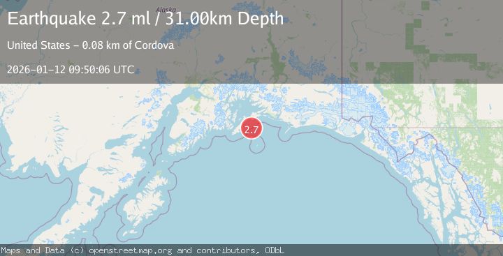
A 2.7 magnitude earthquake struck on GULF OF ALASKA, at Mon, 12 Jan 2026 09:50:06 GMT. Depth: 31km. Reviewed by NEIC seismologists, this minor quake occurred at a magnitude type of ml.
Magnitude
2.7
ml
Source
NEIC
Intensity
-
Agency Reports
1 Sources| Source | Magnitude | Depth | Time |
|---|---|---|---|
| NEICPrimary | 2.7 | 31 km | 1 month ago |
Earthquake Details
AutomaticEvent IDemsc_NEIC_20260112_0000388
Tsunami PotentialNo
Magnitude Typeml
Nearest Places
- Seal Rocks21.7 km
- Seal Rocks21.8 km
- Cape Hinchinbrook28.3 km
- Cape Hinchinbrook Light28.3 km
- Hinchinbrook Lighthouse Reserve29.2 km
Comments
Join the discussion about this event.
Latest Earthquakes
1.6Mag
Kenai Peninsula, Alaska
Time4 minutes ago
Depth42.60 km
SourceVYT (Automatic)
2.4Mag
Finland
Time7 minutes ago
Depth301.88 km
SourceVYT (Automatic)
1.2Mag
Alaska Peninsula
Time7 minutes ago
Depth0.12 km
SourceVYT (Automatic)
4.1Mag
NEAR COAST OF NORTHERN PERU
Time12 minutes ago
Depth35.00 km
SourceLIM (Automatic)
3.1Mag
DODECANESE IS.-TURKEY BORDER REG
Time13 minutes ago
Depth4.10 km
SourceKOERI (Automatic)
Nearby Earthquakes
3.0Mag
GULF OF ALASKA
Time8 years ago
Depth14.00 km
SourceNEIR (Automatic)
3.0Mag
GULF OF ALASKA
Time8 years ago
Depth1.00 km
SourceNEIC (Automatic)
3.0Mag
GULF OF ALASKA
Time8 years ago
Depth16.00 km
SourceNEIR (Automatic)
3.0Mag
SOUTHERN ALASKA
Time4 years ago
Depth11.00 km
SourceNEIC (Automatic)
3.0Mag
SOUTHERN ALASKA
Time2 years ago
Depth8.30 km
SourceAK (Automatic)