Earthquake CENTRAL ALASKA
Fri, 16 Jan 2026 17:02:46 GMT
Time1 month ago
Location
62.9850, -150.9472
Depth
123.8 KM
Event Summary
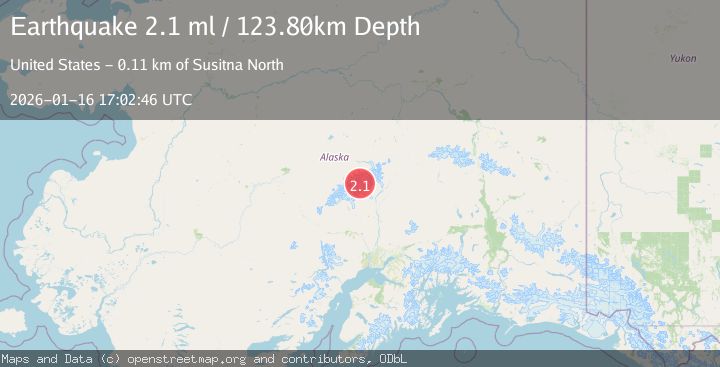
A 2.1 magnitude earthquake struck on CENTRAL ALASKA, at Fri, 16 Jan 2026 17:02:46 GMT. Depth: 123.8km. Reviewed by NEIC seismologists, this minor quake occurred at a magnitude type of ml.
Magnitude
2.1
ml
Source
NEIC
Intensity
-
Agency Reports
1 Sources| Source | Magnitude | Depth | Time |
|---|---|---|---|
| NEICPrimary | 2.1 | 124 km | 1 month ago |
Earthquake Details
AutomaticEvent IDemsc_NEIC_20260116_0000322
Tsunami PotentialNo
Magnitude Typeml
Nearest Places
- West Fork Ruth Glacier2.0 km
- Mount Huntington3.2 km
- Southeast Spur4.5 km
- Ruth Gap4.9 km
- The Rooster Comb5.8 km
Comments
Join the discussion about this event.
Latest Earthquakes
3.0Mag
Java, Indonesia
Time2 minutes ago
Depth29.78 km
SourceBMKG
2.4Mag
Finland-Russia border region
Time4 minutes ago
Depth341.92 km
SourceVYT (Automatic)
0.9Mag
8 km W of Cobb, CA
Time8 minutes ago
Depth1.53 km
SourceUSGS (Automatic)
1.8Mag
Central Alaska
Time11 minutes ago
Depth2.08 km
SourceVYT (Automatic)
2.9Mag
WESTERN TURKEY
Time14 minutes ago
Depth11.80 km
SourceKOERI (Automatic)
Nearby Earthquakes
2.6Mag
CENTRAL ALASKA
Time1 month ago
Depth118.80 km
SourceNEIC (Automatic)
2.2Mag
Central Alaska
Time6 days ago
Depth131.71 km
SourceVYT (Automatic)
3.0Mag
CENTRAL ALASKA
Time3 years ago
Depth112.00 km
SourceNEIC (Automatic)
1.5Mag
Central Alaska
Time1 week ago
Depth10.00 km
SourceVYT (Automatic)
1.4Mag
54 km N of Petersville, Alaska
Time2 weeks ago
Depth124.00 km
SourceUSGS (Automatic)