Earthquake KEPULAUAN BARAT DAYA, INDONESIA
Mon, 19 Jan 2026 07:49:15 GMT
Time1 month ago
Location
-7.5747, 127.6134
Depth
137.8 KM
Event Summary
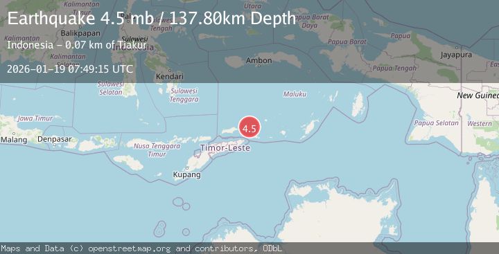
A 4.5 magnitude earthquake struck on KEPULAUAN BARAT DAYA, INDONESIA, at Mon, 19 Jan 2026 07:49:15 GMT. Depth: 137.8km. Reviewed by NEIC seismologists, this light quake occurred at a magnitude type of mb.
Magnitude
4.5
mb
Source
NEIC
Intensity
-
Agency Reports
1 Sources| Source | Magnitude | Depth | Time |
|---|---|---|---|
| NEICPrimary | 4.5 | 138 km | 1 month ago |
Earthquake Details
AutomaticEvent IDemsc_NEIC_20260119_0000133
Tsunami PotentialNo
Magnitude Typemb
Nearest Places
- Pulau Maopora2.1 km
- Pulau Juha2.9 km
- Tanjung Liyiar5.2 km
- Pulau Kital7.0 km
- Pulau Limutu8.8 km
Comments
Join the discussion about this event.
Latest Earthquakes
1.1Mag
Czech Republic
Time16 hours ago
Depth0.00 km
SourceVYT (Automatic)
2.3Mag
FRANCE
Time16 hours ago
Depth5.00 km
SourceReNaSS (Automatic)
2.3Mag
FRANCE
Time16 hours ago
Depth9.20 km
SourceReNaSS (Automatic)
1.9Mag
Southern California
Time16 hours ago
Depth0.00 km
SourceVYT (Automatic)
1.2Mag
WESTERN TURKEY
Time16 hours ago
Depth4.00 km
SourceAFAD (Automatic)
Nearby Earthquakes
3.7Mag
Banda Sea
Time3 weeks ago
Depth206.55 km
SourceBMKG (Automatic)
5.0Mag
KEPULAUAN BARAT DAYA, INDONESIA
Time1 year ago
Depth155.00 km
SourceEMSC (Automatic)
4.0Mag
KEPULAUAN BARAT DAYA, INDONESIA
Time3 years ago
Depth146.00 km
SourceNEIC (Automatic)
7.3Mag
KEPULAUAN BARAT DAYA, INDONESIA
Time4 years ago
Depth170.00 km
SourceEMSC (Automatic)
5.1Mag
KEPULAUAN BARAT DAYA, INDONESIA
Time19 years ago
Depth136.00 km
SourceEMSC (Automatic)