Earthquake SOUTHERN ALASKA
Wed, 21 Jan 2026 16:34:53 GMT
Time3 weeks ago
Location
59.9092, -153.5450
Depth
138.8 KM
Event Summary
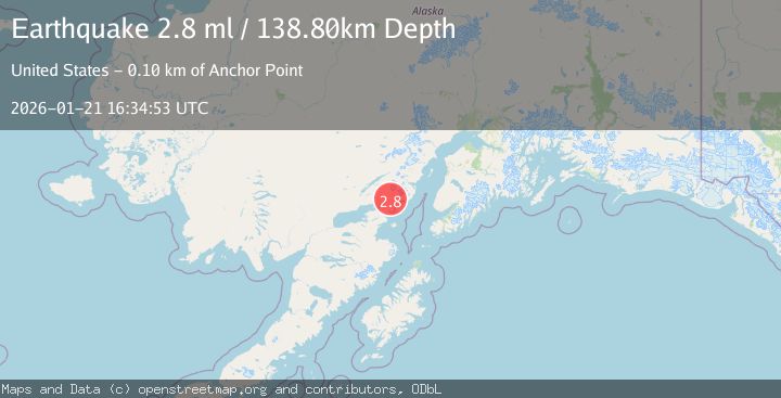
A 2.8 magnitude earthquake struck on SOUTHERN ALASKA, at Wed, 21 Jan 2026 16:34:53 GMT. Depth: 138.8km. Reviewed by NEIC seismologists, this minor quake occurred at a magnitude type of ml.
Magnitude
2.8
ml
Source
NEIC
Intensity
-
Agency Reports
1 Sources| Source | Magnitude | Depth | Time |
|---|---|---|---|
| NEICPrimary | 2.8 | 139 km | 3 weeks ago |
Earthquake Details
AutomaticEvent IDemsc_NEIC_20260121_0000444
Tsunami PotentialNo
Magnitude Typeml
Nearest Places
- Three Sisters Mountain7.3 km
- Roscoe Glacier9.6 km
- Holland Creek13.9 km
- Left Fork West Glacier Creek14.4 km
- Right Fork West Glacier Creek14.5 km
Comments
Join the discussion about this event.
Latest Earthquakes
2.2Mag
Alaska Peninsula
Time3 hours ago
Depth57.74 km
SourceVYT (Automatic)
3.7Mag
WESTERN TURKEY
Time3 hours ago
Depth13.30 km
SourceKOERI (Automatic)
1.6Mag
27 km ESE of Balmorhea, Texas
Time3 hours ago
Depth3.56 km
SourceUSGS (Automatic)
1.6Mag
Southern Alaska
Time3 hours ago
Depth22.22 km
SourceVYT (Automatic)
1.9Mag
Spain
Time3 hours ago
Depth0.00 km
SourceVYT (Automatic)
Nearby Earthquakes
3.2Mag
37 km ENE of Pedro Bay, Alaska
Time1 week ago
Depth119.20 km
SourceUSGS
3.0Mag
SOUTHERN ALASKA
Time7 years ago
Depth168.00 km
SourceNEIC (Automatic)
2.2Mag
37 km ENE of Pedro Bay, Alaska
Time2 weeks ago
Depth152.00 km
SourceUSGS (Automatic)
2.7Mag
SOUTHERN ALASKA
Time1 month ago
Depth145.00 km
SourceNEIC (Automatic)
3.0Mag
SOUTHERN ALASKA
Time9 years ago
Depth158.00 km
SourceNEIR (Automatic)