Earthquake MORO GULF, MINDANAO, PHILIPPINES
Sat, 31 Jan 2026 12:10:05 GMT
Time3 weeks ago
Location
6.1498, 123.7417
Depth
10.0 KM
Event Summary
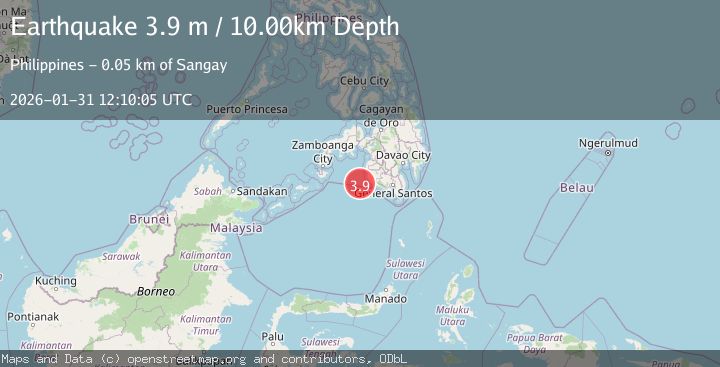
A 3.9 magnitude earthquake struck on MORO GULF, MINDANAO, PHILIPPINES, at Sat, 31 Jan 2026 12:10:05 GMT. Depth: 10km. Reviewed by NEIC seismologists, this minor quake occurred at a magnitude type of m.
Magnitude
3.9
m
Source
NEIC
Intensity
-
Agency Reports
1 Sources| Source | Magnitude | Depth | Time |
|---|---|---|---|
| NEICPrimary | 3.9 | 10 km | 3 weeks ago |
Earthquake Details
AutomaticEvent IDemsc_NEIC_20260131_0000184
Tsunami PotentialNo
Magnitude Typem
Nearest Places
- 43.0 km
- 43.5 km
- 43.6 km
- 43.8 km
- 44.3 km
Comments
Join the discussion about this event.
Latest Earthquakes
1.9Mag
3 km ENE of The Geysers, CA
Time2 minutes ago
Depth0.87 km
SourceUSGS (Automatic)
3.3Mag
Tarapaca, Chile
Time5 minutes ago
Depth66.04 km
SourceVYT (Automatic)
1.5Mag
8 km NNE of Cantwell, Alaska
Time8 minutes ago
Depth8.50 km
SourceUSGS (Automatic)
1.9Mag
Region Metropolitana, Chile
Time9 minutes ago
Depth14.04 km
SourceVYT (Automatic)
1.9Mag
13 km S of Volcano, Hawaii
Time12 minutes ago
Depth1.77 km
SourceUSGS (Automatic)
Nearby Earthquakes
4.7Mag
Mindanao, Philippines
Time2 weeks ago
Depth10.00 km
SourceBMKG (Automatic)
4.6Mag
Mindanao, Philippines
Time3 weeks ago
Depth119.30 km
SourceBMKG (Automatic)
3.2Mag
MORO GULF, MINDANAO, PHILIPPINES
Time3 weeks ago
Depth10.00 km
SourceNEIC (Automatic)
4.5Mag
MORO GULF, MINDANAO, PHILIPPINES
Time1 week ago
Depth35.00 km
SourcePIVS (Automatic)
3.4Mag
MORO GULF, MINDANAO, PHILIPPINES
Time3 weeks ago
Depth10.00 km
SourceNEIC (Automatic)