Earthquake KURIL ISLANDS
Fri, 06 Feb 2026 02:27:56 GMT
Time1 hour ago
Location
50.0525, 157.1154
Depth
39.9 KM
Event Summary
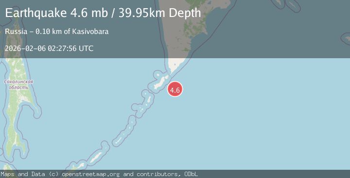
A 4.6 magnitude earthquake struck on KURIL ISLANDS, at Fri, 06 Feb 2026 02:27:56 GMT. Depth: 39.9km. Reviewed by NEIC seismologists, this light quake occurred at a magnitude type of mb.
Magnitude
4.6
mb
Source
NEIC
Intensity
-
Agency Reports
2 Sources| Source | Magnitude | Depth | Time |
|---|---|---|---|
| NEICPrimary | 4.6 | 40 km | 1 hour ago |
| USGS | 4.6 | 40 km | 1 hour ago |
Earthquake Details
AutomaticEvent IDemsc_NEIC_20260206_0000047
Tsunami PotentialNo
Magnitude Typemb
Nearest Places
- Oyashio10.1 km
- Skala Vladimira70.7 km
- Mel’ Koksher72.5 km
- Rif Nezametnyy72.8 km
- Banka Kazach’ya76.4 km
Comments
Join the discussion about this event.
Latest Earthquakes
2.4Mag
Sulawesi, Indonesia
Time7 minutes ago
Depth4.09 km
SourceBMKG (Automatic)
3.1Mag
Flores Sea
Time8 minutes ago
Depth0.00 km
SourceBMKG (Automatic)
2.1Mag
8 km SE of Point MacKenzie, Alaska
Time12 minutes ago
Depth23.10 km
SourceUSGS (Automatic)
1.3Mag
4 km SSW of Brawley, CA
Time16 minutes ago
Depth6.06 km
SourceUSGS (Automatic)
2.2Mag
Sumbawa Region, Indonesia
Time19 minutes ago
Depth10.00 km
SourceBMKG (Automatic)
Nearby Earthquakes
5.5Mag
KURIL ISLANDS
Time1 week ago
Depth53.00 km
SourceEMSC (Automatic)
5.0Mag
KURIL ISLANDS
Time6 days ago
Depth75.30 km
SourceGFZ (Automatic)
4.8Mag
KURIL ISLANDS
Time1 week ago
Depth94.00 km
SourceEMSC (Automatic)
5.2Mag
EAST OF KURIL ISLANDS
Time1 week ago
Depth13.00 km
SourceEMSC (Automatic)
5.3Mag
OFF EAST COAST OF KAMCHATKA
Time1 week ago
Depth48.00 km
SourceEMSC (Automatic)