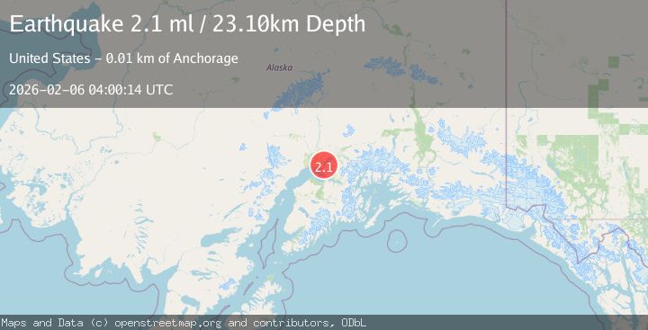
Earthquake 8 km SE of Point MacKenzie, Alaska
Fri, 06 Feb 2026 04:00:14 GMT
Time1 hour ago
Location
61.3050, -149.8720
Depth
23.1 KM
Event Summary
A 2.1 magnitude earthquake struck on 8 km SE of Point MacKenzie, Alaska, at Fri, 06 Feb 2026 04:00:14 GMT. Depth: 23.1km. Reviewed by USGS seismologists, this minor quake occurred at a magnitude type of ml.
Magnitude
2.1
ml
Source
USGS
Intensity
-
Agency Reports
1 Sources| Source | Magnitude | Depth | Time |
|---|---|---|---|
| USGSPrimary | 2.1 | 23 km | 1 hour ago |
Earthquake Details
AutomaticEvent IDusgs_ak2026cokcru
Tsunami PotentialNo
Magnitude Typeml
Nearest Places
- Sixmile Creek2.4 km
- Mule Creek3.3 km
- Green Lake3.4 km
- Gregory Lake Dam3.4 km
- Tuomi3.6 km
Comments
Join the discussion about this event.
Latest Earthquakes
3.1Mag
Java Sea
Time4 minutes ago
Depth10.00 km
SourceBMKG (Automatic)
1.6Mag
98 km NW of Yakutat, Alaska
Time24 minutes ago
Depth23.10 km
SourceUSGS (Automatic)
1.0Mag
WESTERN TURKEY
Time25 minutes ago
Depth7.00 km
SourceAFAD (Automatic)
3.5Mag
Southern Sumatra, Indonesia
Time30 minutes ago
Depth67.02 km
SourceBMKG (Automatic)
2.8Mag
Bali Region, Indonesia
Time32 minutes ago
Depth94.28 km
SourceBMKG (Automatic)
Nearby Earthquakes
1.9Mag
6 km NNE of Anchorage, Alaska
Time10 hours ago
Depth32.40 km
SourceUSGS
1.9Mag
2 km W of Elmendorf Air Force Base, Alaska
Time5 days ago
Depth32.40 km
SourceUSGS (Automatic)
2.4Mag
7 km NW of Point MacKenzie, Alaska
Time1 week ago
Depth32.70 km
SourceUSGS (Automatic)
2.5Mag
5 km SE of Elmendorf Air Force Base, Alaska
Time1 week ago
Depth39.60 km
SourceUSGS (Automatic)
3.5Mag
SOUTHERN ALASKA
Time5 days ago
Depth20.80 km
SourceAK (Automatic)