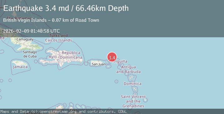
Earthquake VIRGIN ISLANDS REGION
Mon, 09 Feb 2026 01:27:31 GMT
Time1 hour ago
Location
18.9398, -64.6443
Depth
35.0 KM
Event Summary
A 3.2 magnitude earthquake struck on VIRGIN ISLANDS REGION, at Mon, 09 Feb 2026 01:27:31 GMT. Depth: 35km. Reviewed by NEIC seismologists, this minor quake occurred at a magnitude type of ml.
Magnitude
3.2
ml
Source
NEIC
Intensity
-
Agency Reports
1 Sources| Source | Magnitude | Depth | Time |
|---|---|---|---|
| NEICPrimary | 3.2 | 35 km | 1 hour ago |
Earthquake Details
AutomaticEvent IDemsc_NEIC_20260209_0000020
Tsunami PotentialNo
Magnitude Typeml
Nearest Places
- Whale Banks27.3 km
- West End Point32.6 km
- Walkover Set Point32.7 km
- West End32.8 km
- Ruffling Point32.9 km
Comments
Join the discussion about this event.
Latest Earthquakes
2.5Mag
Northern Sumatra, Indonesia
Time1 hour ago
Depth4.77 km
SourceBMKG (Automatic)
1.6Mag
4 km ENE of Saint Helena, CA
Time1 hour ago
Depth8.01 km
SourceUSGS (Automatic)
2.6Mag
West Papua Region, Indonesia
Time2 hours ago
Depth10.00 km
SourceBMKG (Automatic)
1.6Mag
SPAIN
Time2 hours ago
Depth15.00 km
SourceIGN (Automatic)
1.3Mag
WESTERN TURKEY
Time2 hours ago
Depth9.50 km
SourceAFAD (Automatic)
Nearby Earthquakes
3.5Mag
73 km N of Cruz Bay, U.S. Virgin Islands
Time2 weeks ago
Depth46.00 km
SourceUSGS
3.8Mag
VIRGIN ISLANDS REGION
Time5 hours ago
Depth40.90 km
SourceNEIC (Automatic)
3.7Mag
VIRGIN ISLANDS REGION
Time1 day ago
Depth35.00 km
SourceNEIC (Automatic)
3.2Mag
VIRGIN ISLANDS REGION
Time2 weeks ago
Depth20.60 km
SourcePR (Automatic)
3.3Mag
VIRGIN ISLANDS REGION
Time2 weeks ago
Depth28.60 km
SourcePR (Automatic)