Earthquake VANCOUVER ISLAND, CANADA REGION
Mon, 16 Jun 2014 20:40:41 GMT
Time11 years ago
Location
48.5200, -123.2700
Depth
24.0 KM
Event Summary
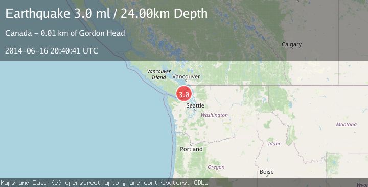
A 3.0 magnitude earthquake struck on VANCOUVER ISLAND, CANADA REGION, at Mon, 16 Jun 2014 20:40:41 GMT. Depth: 24km. Reviewed by NEIR seismologists, this minor quake occurred at a magnitude type of ml.
Magnitude
3.0
ml
Source
NEIR
Intensity
-
Agency Reports
1 Sources| Source | Magnitude | Depth | Time |
|---|---|---|---|
| NEIRPrimary | 3.0 | 24 km | 11 years ago |
Earthquake Details
AutomaticEvent IDemsc_NEIR_20140616_0000078
Tsunami PotentialNo
Magnitude Typeml
Nearest Places
- 1.2 km
- 1.7 km
- 3.3 km
- 3.3 km
- 3.5 km
Comments
Join the discussion about this event.
Latest Earthquakes
2.4Mag
Fox Islands, Aleutian Islands, Alaska
Time1 minute ago
Depth16.72 km
SourceVYT (Automatic)
3.1Mag
south of Java, Indonesia
Time2 minutes ago
Depth0.24 km
SourceVYT (Automatic)
0.4Mag
6 km WNW of The Geysers, CA
Time7 minutes ago
Depth3.13 km
SourceUSGS (Automatic)
3.1Mag
Sulawesi, Indonesia
Time8 minutes ago
Depth0.00 km
SourceVYT (Automatic)
2.7Mag
Libertador General Bernardo O'Higgins, Chile
Time15 minutes ago
Depth0.00 km
SourceVYT (Automatic)
Nearby Earthquakes
2.8Mag
12 km WSW of Anacortes, Washington
Time1 month ago
Depth11.39 km
SourceUSGS
3.0Mag
OLYMPIC PENINSULA, WASHINGTON
Time5 years ago
Depth43.00 km
SourceNEIC (Automatic)
3.0Mag
PUGET SOUND REGION, WASHINGTON
Time8 years ago
Depth23.00 km
SourceNEIR (Automatic)
3.0Mag
PUGET SOUND REGION, WASHINGTON
Time9 years ago
Depth24.00 km
SourceNEIC (Automatic)
3.0Mag
SAN JUAN ISLANDS REG, WASHINGTON
Time8 years ago
Depth15.00 km
SourceNEIC (Automatic)