Earthquake SOUTHERN CALIFORNIA
Fri, 12 Dec 2014 19:08:31 GMT
Time11 years ago
Location
34.0500, -116.9800
Depth
16.0 KM
Event Summary
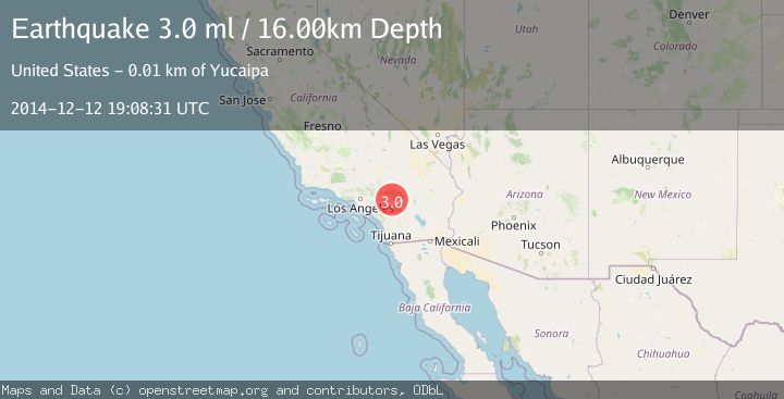
A 3.0 magnitude earthquake struck on SOUTHERN CALIFORNIA, at Fri, 12 Dec 2014 19:08:31 GMT. Depth: 16km. Reviewed by NEIR seismologists, this minor quake occurred at a magnitude type of ml.
Magnitude
3.0
ml
Source
NEIR
Intensity
-
Agency Reports
1 Sources| Source | Magnitude | Depth | Time |
|---|---|---|---|
| NEIRPrimary | 3.0 | 16 km | 11 years ago |
Earthquake Details
AutomaticEvent IDemsc_NEIR_20141212_0000062
Tsunami PotentialNo
Magnitude Typeml
Nearest Places
- Potato Canyon0.5 km
- Birch Creek1.5 km
- San Bernardino National Forest2.2 km
- Pisgah Peak2.7 km
- KLRD-FM (Yucaipa)2.8 km
Comments
Join the discussion about this event.
Latest Earthquakes
2.5Mag
West Papua Region, Indonesia
Time4 minutes ago
Depth12.37 km
SourceBMKG
2.6Mag
Antofagasta, Chile
Time5 minutes ago
Depth116.33 km
SourceVYT (Automatic)
1.1Mag
Northern Territory, Australia
Time7 minutes ago
Depth0.00 km
SourceVYT (Automatic)
3.7Mag
NEAR THE COAST OF WESTERN TURKEY
Time10 minutes ago
Depth8.00 km
SourceTHE (Automatic)
2.2Mag
Central Alaska
Time11 minutes ago
Depth131.71 km
SourceVYT (Automatic)
Nearby Earthquakes
2.2Mag
Southern California
Time1 week ago
Depth16.97 km
SourceVYT (Automatic)
5.3Mag
GREATER LOS ANGELES AREA, CALIF.
Time20 years ago
Depth13.00 km
SourceNEIC (Automatic)
3.0Mag
SOUTHERN CALIFORNIA
Time2 years ago
Depth5.00 km
SourceNEIC (Automatic)
1.8Mag
Southern California
Time1 week ago
Depth18.43 km
SourceVYT (Automatic)
3.0Mag
SOUTHERN CALIFORNIA
Time1 year ago
Depth25.10 km
SourceNEIC (Automatic)