Earthquake ISLAND OF HAWAII, HAWAII
Fri, 19 Feb 2016 10:13:10 GMT
Time10 years ago
Location
19.3600, -155.2100
Depth
2.0 KM
Event Summary
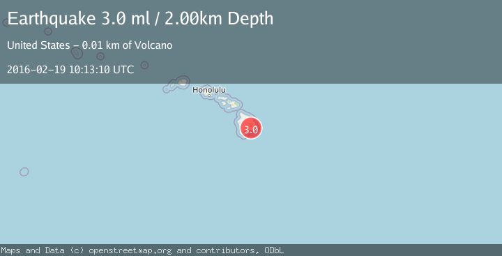
A 3.0 magnitude earthquake struck on ISLAND OF HAWAII, HAWAII, at Fri, 19 Feb 2016 10:13:10 GMT. Depth: 2km. Reviewed by NEIR seismologists, this minor quake occurred at a magnitude type of ml.
Magnitude
3.0
ml
Source
NEIR
Intensity
-
Agency Reports
1 Sources| Source | Magnitude | Depth | Time |
|---|---|---|---|
| NEIRPrimary | 3.0 | 2 km | 10 years ago |
Earthquake Details
AutomaticEvent IDemsc_NEIR_20160219_0000044
Tsunami PotentialNo
Magnitude Typeml
Nearest Places
- Aloi Crater0.6 km
- Mauna Ulu Lava Shield1.2 km
- Mau Loa O Mauna Ulu Overlook1.3 km
- Mauna Ulu1.3 km
- Pu‘u Huluhulu1.4 km
Comments
Join the discussion about this event.
Latest Earthquakes
1.6Mag
Kenai Peninsula, Alaska
Time4 minutes ago
Depth42.60 km
SourceVYT (Automatic)
2.4Mag
Finland
Time7 minutes ago
Depth301.88 km
SourceVYT (Automatic)
1.2Mag
Alaska Peninsula
Time7 minutes ago
Depth0.12 km
SourceVYT (Automatic)
4.1Mag
NEAR COAST OF NORTHERN PERU
Time12 minutes ago
Depth35.00 km
SourceLIM (Automatic)
3.1Mag
DODECANESE IS.-TURKEY BORDER REG
Time14 minutes ago
Depth4.10 km
SourceKOERI (Automatic)
Nearby Earthquakes
3.0Mag
ISLAND OF HAWAII, HAWAII
Time1 year ago
Depth5.00 km
SourceNEIC (Automatic)
3.0Mag
ISLAND OF HAWAII, HAWAII
Time7 months ago
Depth6.40 km
SourceHV (Automatic)
3.0Mag
ISLAND OF HAWAII, HAWAII
Time1 year ago
Depth1.60 km
SourceHV (Automatic)
3.0Mag
ISLAND OF HAWAII, HAWAII
Time1 year ago
Depth5.00 km
SourceNEIC (Automatic)
5.0Mag
ISLAND OF HAWAII, HAWAII
Time10 years ago
Depth9.00 km
SourceNEIR (Automatic)