Earthquake ISLAND OF HAWAII, HAWAII
Sun, 10 Sep 2017 08:15:06 GMT
Time8 years ago
Location
19.0900, -155.3900
Depth
43.0 KM
Event Summary
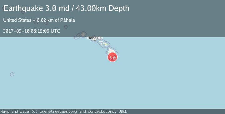
A 3.0 magnitude earthquake struck on ISLAND OF HAWAII, HAWAII, at Sun, 10 Sep 2017 08:15:06 GMT. Depth: 43km. Reviewed by NEIR seismologists, this minor quake occurred at a magnitude type of md.
Magnitude
3.0
md
Source
NEIR
Intensity
-
Agency Reports
1 Sources| Source | Magnitude | Depth | Time |
|---|---|---|---|
| NEIRPrimary | 3.0 | 43 km | 8 years ago |
Earthquake Details
AutomaticEvent IDemsc_NEIR_20170910_0000043
Tsunami PotentialNo
Magnitude Typemd
Nearest Places
- Ahole Heiau7.9 km
- Palima Point9.1 km
- Waioala Spring9.2 km
- Pueo9.3 km
- Ulekuwale9.4 km
Comments
Join the discussion about this event.
Latest Earthquakes
3.0Mag
Antofagasta, Chile
Time2 minutes ago
Depth108.89 km
SourceVYT (Automatic)
1.7Mag
STRAIT OF GIBRALTAR
Time12 minutes ago
Depth15.80 km
SourceIGN (Automatic)
0.9Mag
WESTERN TURKEY
Time14 minutes ago
Depth11.10 km
SourceAFAD (Automatic)
3.2Mag
Croatia-Bosnia and Herzegovina border region
Time15 minutes ago
Depth63.84 km
SourceVYT (Automatic)
1.0Mag
Southern Alaska
Time20 minutes ago
Depth13.43 km
SourceVYT (Automatic)
Nearby Earthquakes
2.4Mag
ISLAND OF HAWAII, HAWAII
Time1 month ago
Depth35.00 km
SourceNEIC (Automatic)
2.9Mag
ISLAND OF HAWAII, HAWAII
Time1 month ago
Depth37.70 km
SourceNEIC (Automatic)
2.6Mag
ISLAND OF HAWAII, HAWAII
Time1 month ago
Depth40.30 km
SourceNEIC (Automatic)
1.7Mag
16 km SE of Pāhala, Hawaii
Time1 week ago
Depth33.76 km
SourceUSGS (Automatic)
3.0Mag
ISLAND OF HAWAII, HAWAII
Time3 days ago
Depth33.80 km
SourceHV (Automatic)