Earthquake ISLAND OF HAWAII, HAWAII
Fri, 15 Sep 2017 01:45:44 GMT
Time8 years ago
Location
19.2000, -155.4700
Depth
35.0 KM
Event Summary
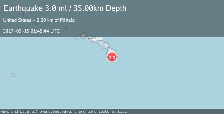
A 3.0 magnitude earthquake struck on ISLAND OF HAWAII, HAWAII, at Fri, 15 Sep 2017 01:45:44 GMT. Depth: 35km. Reviewed by NEIR seismologists, this minor quake occurred at a magnitude type of ml.
Magnitude
3.0
ml
Source
NEIR
Intensity
-
Agency Reports
1 Sources| Source | Magnitude | Depth | Time |
|---|---|---|---|
| NEIRPrimary | 3.0 | 35 km | 8 years ago |
Earthquake Details
AutomaticEvent IDemsc_NEIR_20170915_0000005
Tsunami PotentialNo
Magnitude Typeml
Nearest Places
- Kau Hospital0.2 km
- ‘Iliokōloa0.3 km
- Hawaii County Fire Department Station 11 Pahala0.3 km
- Pahala Park and Community Center0.5 km
- Pā‘au‘au 20.5 km
Comments
Join the discussion about this event.
Latest Earthquakes
1.4Mag
Central Alaska
Time15 hours ago
Depth0.00 km
SourceVYT (Automatic)
1.4Mag
western Texas
Time15 hours ago
Depth6.84 km
SourceVYT (Automatic)
1.3Mag
Southern Alaska
Time15 hours ago
Depth96.80 km
SourceVYT (Automatic)
2.2Mag
Java, Indonesia
Time15 hours ago
Depth97.25 km
SourceBMKG
2.9Mag
Ceram Sea
Time15 hours ago
Depth12.69 km
SourceBMKG
Nearby Earthquakes
3.0Mag
ISLAND OF HAWAII, HAWAII
Time7 years ago
Depth32.00 km
SourceNEIR (Automatic)
3.0Mag
ISLAND OF HAWAII, HAWAII
Time4 years ago
Depth42.00 km
SourceNEIC (Automatic)
3.0Mag
ISLAND OF HAWAII, HAWAII
Time4 years ago
Depth36.00 km
SourceNEIC (Automatic)
3.0Mag
ISLAND OF HAWAII, HAWAII
Time4 years ago
Depth40.00 km
SourceNEIC (Automatic)
3.0Mag
ISLAND OF HAWAII, HAWAII
Time4 years ago
Depth40.00 km
SourceNEIC (Automatic)