Earthquake ISLAND OF HAWAII, HAWAII
Fri, 06 Jul 2018 17:59:08 GMT
Time7 years ago
Location
19.2100, -155.4300
Depth
31.0 KM
Event Summary
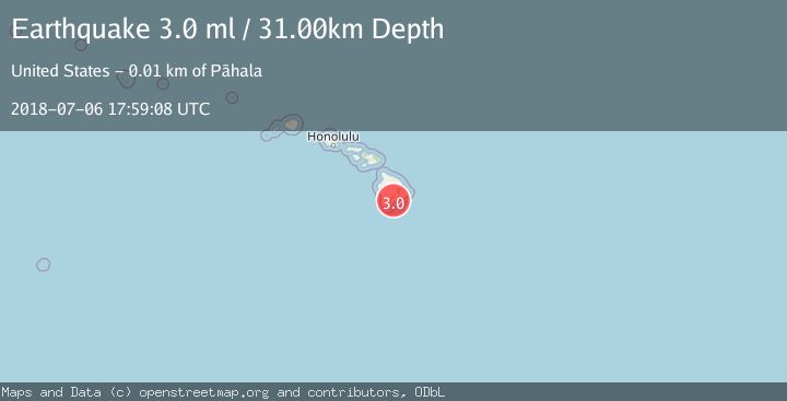
A 3.0 magnitude earthquake struck on ISLAND OF HAWAII, HAWAII, at Fri, 06 Jul 2018 17:59:08 GMT. Depth: 31km. Reviewed by NEIR seismologists, this minor quake occurred at a magnitude type of ml.
Magnitude
3.0
ml
Source
NEIR
Intensity
-
Agency Reports
1 Sources| Source | Magnitude | Depth | Time |
|---|---|---|---|
| NEIRPrimary | 3.0 | 31 km | 7 years ago |
Earthquake Details
AutomaticEvent IDemsc_NEIR_20180706_0000277
Tsunami PotentialNo
Magnitude Typeml
Nearest Places
- Holua Slide0.6 km
- Puu Ulaula0.7 km
- Halelua1.5 km
- Lava Plastered Cones1.7 km
- Great Crack1.7 km
Comments
Join the discussion about this event.
Latest Earthquakes
1.6Mag
Southern Alaska
Time8 minutes ago
Depth48.58 km
SourceVYT (Automatic)
2.3Mag
Antofagasta, Chile
Time10 minutes ago
Depth82.15 km
SourceVYT (Automatic)
2.1Mag
Southern Alaska
Time13 minutes ago
Depth64.21 km
SourceVYT (Automatic)
2.5Mag
Central Alaska
Time18 minutes ago
Depth312.99 km
SourceVYT (Automatic)
3.6Mag
Banda Sea
Time25 minutes ago
Depth0.00 km
SourceVYT (Automatic)
Nearby Earthquakes
3.0Mag
ISLAND OF HAWAII, HAWAII
Time5 years ago
Depth43.00 km
SourceNEIC (Automatic)
3.0Mag
ISLAND OF HAWAII, HAWAII
Time5 years ago
Depth42.00 km
SourceNEIC (Automatic)
3.0Mag
ISLAND OF HAWAII, HAWAII
Time4 years ago
Depth38.00 km
SourceNEIC (Automatic)
3.0Mag
ISLAND OF HAWAII, HAWAII
Time5 years ago
Depth42.00 km
SourceNEIC (Automatic)
3.0Mag
ISLAND OF HAWAII, HAWAII
Time4 years ago
Depth38.00 km
SourceNEIC (Automatic)