Earthquake KODIAK ISLAND REGION, ALASKA
Tue, 18 Feb 2020 07:29:20 GMT
Time6 years ago
Location
58.4200, -151.3800
Depth
10.0 KM
Event Summary
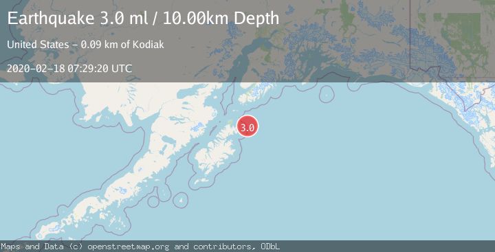
A 3.0 magnitude earthquake struck on KODIAK ISLAND REGION, ALASKA, at Tue, 18 Feb 2020 07:29:20 GMT. Depth: 10km. Reviewed by NEIR seismologists, this minor quake occurred at a magnitude type of ml.
Magnitude
3.0
ml
Source
NEIR
Intensity
-
Agency Reports
1 Sources| Source | Magnitude | Depth | Time |
|---|---|---|---|
| NEIRPrimary | 3.0 | 10 km | 6 years ago |
Earthquake Details
AutomaticEvent IDemsc_NEIR_20200218_0000049
Tsunami PotentialNo
Magnitude Typeml
Nearest Places
- Sealion Rocks26.7 km
- Cape Saint Hermogenes30.4 km
- Marmot Island35.2 km
- Tonki Cape Light36.1 km
- Tonki Cape36.1 km
Comments
Join the discussion about this event.
Latest Earthquakes
2.5Mag
Bering Strait
Time4 minutes ago
Depth200.07 km
SourceVYT (Automatic)
2.3Mag
Sumbawa Region, Indonesia
Time4 minutes ago
Depth10.00 km
SourceBMKG
1.6Mag
13 km ENE of Falls City, Texas
Time14 minutes ago
Depth7.18 km
SourceUSGS (Automatic)
1.5Mag
EASTERN TURKEY
Time17 minutes ago
Depth7.00 km
SourceAFAD (Automatic)
1.3Mag
5 km S of Cabazon, CA
Time17 minutes ago
Depth5.80 km
SourceUSGS (Automatic)
Nearby Earthquakes
3.0Mag
KODIAK ISLAND REGION, ALASKA
Time5 years ago
Depth4.00 km
SourceNEIC (Automatic)
5.0Mag
KODIAK ISLAND REGION, ALASKA
Time6 years ago
Depth30.00 km
SourceEMSC (Automatic)
3.0Mag
KODIAK ISLAND REGION, ALASKA
Time7 years ago
Depth9.00 km
SourceNEIR (Automatic)
2.7Mag
KODIAK ISLAND REGION, ALASKA
Time2 months ago
Depth35.00 km
SourceNEIC (Automatic)
3.0Mag
KODIAK ISLAND REGION, ALASKA
Time6 years ago
Depth41.00 km
SourceNEIC (Automatic)