Earthquake AZORES ISLANDS REGION
Wed, 18 Feb 2026 00:47:58 GMT
Time11 hours ago
Location
37.0110, -24.3350
Depth
15.0 KM
Event Summary
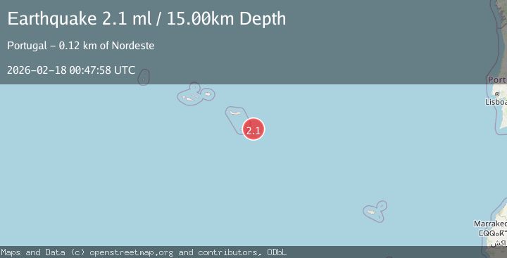
A 2.1 magnitude earthquake struck on AZORES ISLANDS REGION, at Wed, 18 Feb 2026 00:47:58 GMT. Depth: 15km. Reviewed by PDA seismologists, this minor quake occurred at a magnitude type of ml.
Magnitude
2.1
ml
Source
PDA
Intensity
-
Agency Reports
1 Sources| Source | Magnitude | Depth | Time |
|---|---|---|---|
| PDAPrimary | 2.1 | 15 km | 11 hours ago |
Earthquake Details
AutomaticEvent IDemsc_PDA_20260218_0000013
Tsunami PotentialNo
Magnitude Typeml
Nearest Places
- Ilhéus das Formigas48.9 km
- Baixa do Maía60.3 km
- Ponta do Cedro60.7 km
- Maía60.8 km
- Ponta do Castelete61.0 km
Comments
Join the discussion about this event.
Latest Earthquakes
2.4Mag
Antofagasta, Chile
Time11 hours ago
Depth141.60 km
SourceVYT (Automatic)
3.6Mag
Sulawesi, Indonesia
Time11 hours ago
Depth8.18 km
SourceVYT (Automatic)
2.0Mag
Sumbawa Region, Indonesia
Time11 hours ago
Depth25.89 km
SourceBMKG
1.0Mag
Southern Alaska
Time11 hours ago
Depth95.46 km
SourceVYT (Automatic)
1.7Mag
42 km NW of Toyah, Texas
Time11 hours ago
Depth4.46 km
SourceUSGS (Automatic)
Nearby Earthquakes
2.0Mag
AZORES ISLANDS REGION
Time1 month ago
Depth10.00 km
SourcePDA (Automatic)
3.0Mag
AZORES ISLANDS REGION
Time5 years ago
Depth5.00 km
SourcePDA (Automatic)
3.0Mag
AZORES ISLANDS REGION
Time18 years ago
Depth10.00 km
SourcePDA (Automatic)
3.0Mag
AZORES ISLANDS REGION
Time2 years ago
Depth10.00 km
SourcePDA (Automatic)
3.0Mag
AZORES ISLANDS REGION
Time10 years ago
Depth10.00 km
SourcePDA (Automatic)