Earthquake MORO GULF, MINDANAO, PHILIPPINES
Wed, 21 Jan 2026 13:26:11 GMT
Time6 days ago
Location
6.4500, 123.6400
Depth
23.0 KM
Event Summary
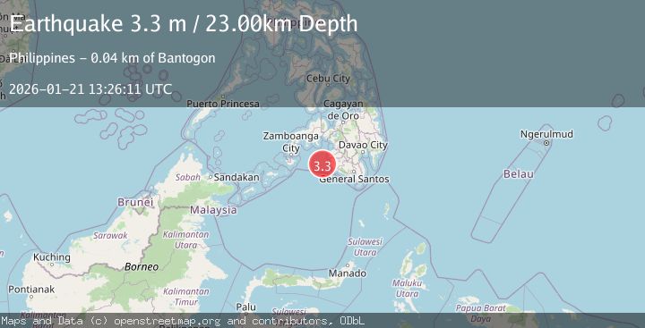
A 3.3 magnitude earthquake struck on MORO GULF, MINDANAO, PHILIPPINES, at Wed, 21 Jan 2026 13:26:11 GMT. Depth: 23km. Reviewed by PIVS seismologists, this minor quake occurred at a magnitude type of m.
Magnitude
3.3
m
Source
PIVS
Intensity
-
Agency Reports
1 Sources| Source | Magnitude | Depth | Time |
|---|---|---|---|
| PIVSPrimary | 3.3 | 23 km | 6 days ago |
Earthquake Details
AutomaticEvent IDemsc_PIVS_20260121_0000245
Tsunami PotentialNo
Magnitude Typem
Nearest Places
- Donaung Shoals39.1 km
- Donauang Island42.3 km
- Basiauang Bay43.0 km
- Nara Point43.0 km
- Danawan Point43.1 km
Comments
Join the discussion about this event.
Latest Earthquakes
1.2Mag
13 km WSW of Stanton, Texas
Time18 hours ago
Depth3.46 km
SourceUSGS (Automatic)
2.0Mag
WESTERN TURKEY
Time18 hours ago
Depth7.60 km
SourceKOERI (Automatic)
4.4Mag
Sulawesi, Indonesia
Time18 hours ago
Depth5.00 km
SourceBMKG (Automatic)
1.1Mag
11 km N of Quilcene, Washington
Time18 hours ago
Depth20.76 km
SourceUSGS
1.8Mag
PYRENEES
Time18 hours ago
Depth1.40 km
SourceIGN (Automatic)
Nearby Earthquakes
3.1Mag
MORO GULF, MINDANAO, PHILIPPINES
Time6 days ago
Depth9.00 km
SourcePIVS (Automatic)
3.3Mag
MORO GULF, MINDANAO, PHILIPPINES
Time5 days ago
Depth2.00 km
SourcePIVS (Automatic)
3.1Mag
MORO GULF, MINDANAO, PHILIPPINES
Time6 days ago
Depth15.00 km
SourcePIVS (Automatic)
3.6Mag
MORO GULF, MINDANAO, PHILIPPINES
Time1 day ago
Depth3.00 km
SourcePIVS (Automatic)
3.2Mag
MORO GULF, MINDANAO, PHILIPPINES
Time1 day ago
Depth3.00 km
SourcePIVS (Automatic)