Earthquake PHILIPPINE ISLANDS REGION
Tue, 17 Feb 2026 22:23:50 GMT
Time9 hours ago
Location
8.6400, 127.2500
Depth
9.0 KM
Event Summary
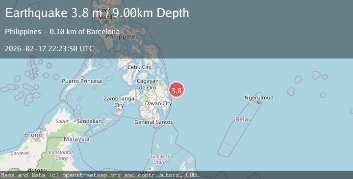
A 3.8 magnitude earthquake struck on PHILIPPINE ISLANDS REGION, at Tue, 17 Feb 2026 22:23:50 GMT. Depth: 9km. Reviewed by PIVS seismologists, this minor quake occurred at a magnitude type of m.
Magnitude
3.8
m
Source
PIVS
Intensity
-
Agency Reports
1 Sources| Source | Magnitude | Depth | Time |
|---|---|---|---|
| PIVSPrimary | 3.8 | 9 km | 9 hours ago |
Earthquake Details
AutomaticEvent IDemsc_PIVS_20260217_0000341
Tsunami PotentialNo
Magnitude Typem
Nearest Places
- Philippine Trench48.5 km
- Lamon Point95.7 km
- Singag Island96.0 km
- Tigdos Island96.7 km
- Port Lamon96.9 km
Comments
Join the discussion about this event.
Latest Earthquakes
3.8Mag
Andreanof Islands, Aleutian Islands, Alaska
Time9 hours ago
Depth15.50 km
SourceVYT (Automatic)
1.7Mag
40 km NW of Toyah, Texas
Time9 hours ago
Depth4.25 km
SourceUSGS (Automatic)
1.3Mag
SWITZERLAND
Time9 hours ago
Depth7.60 km
SourceETHZ (Automatic)
2.7Mag
Andreanof Islands, Aleutian Islands, Alaska
Time9 hours ago
Depth29.17 km
SourceVYT (Automatic)
1.6Mag
44 km NW of Toyah, Texas
Time9 hours ago
Depth0.00 km
SourceUSGS (Automatic)
Nearby Earthquakes
3.0Mag
PHILIPPINE ISLANDS REGION
Time3 years ago
Depth18.00 km
SourcePIVS (Automatic)
3.0Mag
PHILIPPINE ISLANDS REGION
Time2 years ago
Depth3.00 km
SourcePIVS (Automatic)
3.0Mag
PHILIPPINE ISLANDS REGION
Time1 year ago
Depth33.00 km
SourcePIVS (Automatic)
3.0Mag
PHILIPPINE ISLANDS REGION
Time2 years ago
Depth39.00 km
SourcePIVS (Automatic)
3.0Mag
PHILIPPINE ISLANDS REGION
Time2 years ago
Depth25.00 km
SourcePIVS (Automatic)