Earthquake PERU-ECUADOR BORDER REGION
Thu, 12 Feb 2026 21:52:56 GMT
Time2 months ago
Location
-2.4800, -77.6200
Depth
119.0 KM
Event Summary
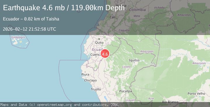
A 4.6 magnitude earthquake struck on PERU-ECUADOR BORDER REGION, at Thu, 12 Feb 2026 21:52:56 GMT. Depth: 119km. Reviewed by QUI seismologists, this light quake occurred at a magnitude type of mb.
Magnitude
4.6
mb
Source
QUI
Intensity
II
Agency Reports
2 Sources| Source | Magnitude | Depth | Time |
|---|---|---|---|
| QUIPrimary | 4.6 | 119 km | 2 months ago |
| EMSC | 4.6 | 119 km | 2 months ago |
Earthquake Details
AutomaticEvent IDemsc_QUI_20260212_0000291
QualityS
Tsunami PotentialNo
Magnitude Typemb
Last Update2 months ago
Nearest Places
Possibly felt by: 205.9K
- IITaisha23.6 km
- IIMacas57.8 km23.7K people
- IISucúa61.3 km7.4K people
- IIMontalvo83.1 km
- IIPalora94.7 km6.5K people
- IPuyo118.7 km24.9K people
- 135.6 km1.6K people
- 136.6 km17.1K people
- 138.4 km
- 139.5 km34.9K people
- 139.8 km14.3K people
- 145.0 km4.6K people
- 145.3 km264K people
- 146.8 km4.5K people
- 146.8 km9.9K people
- 148.2 km4.6K people
- 148.4 km12.7K people
- 149.9 km9.5K people
- 160.7 km637K people
- 164.0 km16.6K people
- 164.3 km
- ITena166.6 km17.2K people
- 172.0 km471 people
- 175.9 km7.3K people
- 176.1 km
- 176.1 km387.3K people
- 178.0 km7.5K people
- 179.9 km12.6K people
- 182.4 km22.2K people
- 191.2 km36.4K people
- 192.6 km10.8K people
- 196.6 km10K people
- 200.6 km15.5K people
- 203.6 km7.3K people
- 204.3 km205.6K people
- 205.2 km20.3K people
- 207.3 km16.2K people
- 208.0 km34.2K people
- 216.3 km3.8K people
- 219.9 km12.6K people
- 222.7 km133.5K people
- 223.0 km32K people
- 225.7 km76.3K people
- 227.2 km7K people
- 227.9 km9.7K people
- 230.4 km15.3K people
- 233.0 km
- 234.4 km27.9K people
- 234.7 km48.1K people
- 234.8 km38.2K people
Felt Reports0
Did you feel this earthquake? Report it to help others.
No reports yet
Be the first to report this earthquake!
Latest Earthquakes
Loading...
Nearby Earthquakes
4.6Mag
Ecuador
Time1 week ago
Depth174.44 km
SourceVYT (Automatic)
3.0Mag
Ecuador
Time2 weeks ago
Depth128.05 km
SourceVYT (Automatic)
2.9Mag
Ecuador
Time3 weeks ago
Depth0.00 km
SourceVYT (Automatic)
3.4Mag
Ecuador
Time1 month ago
Depth25.76 km
SourceVYT (Automatic)
3.5Mag
PERU-ECUADOR BORDER REGION
Time2 months ago
Depth64.00 km
SourceQUI (Automatic)