Earthquake SOUTHERN CALIFORNIA
Tue, 06 Jan 2026 12:44:52 GMT
Time1 month ago
Location
32.9280, -116.2973
Depth
8.5 KM
Event Summary
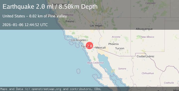
A 2.0 magnitude earthquake struck on SOUTHERN CALIFORNIA, at Tue, 06 Jan 2026 12:44:52 GMT. Depth: 8.5km. Reviewed by SCSN seismologists, this minor quake occurred at a magnitude type of ml.
Magnitude
2.0
ml
Source
SCSN
Intensity
-
Agency Reports
1 Sources| Source | Magnitude | Depth | Time |
|---|---|---|---|
| SCSNPrimary | 2.0 | 9 km | 1 month ago |
Earthquake Details
AutomaticEvent IDemsc_SCSN_20260106_0000227
Tsunami PotentialNo
Magnitude Typeml
Nearest Places
- Moonlight Canyon2.3 km
- Inner Pasture2.4 km
- Agua Caliente Springs2.5 km
- Squaw Canyon2.8 km
- Agua Caliente County Park2.8 km
Comments
Join the discussion about this event.
Latest Earthquakes
1.5Mag
Region Metropolitana, Chile
Time9 hours ago
Depth0.12 km
SourceVYT (Automatic)
2.9Mag
Antofagasta, Chile
Time9 hours ago
Depth143.43 km
SourceVYT (Automatic)
1.7Mag
Central Alaska
Time9 hours ago
Depth18.92 km
SourceVYT (Automatic)
1.7Mag
51 km NW of Ivanof Bay, Alaska
Time9 hours ago
Depth48.60 km
SourceUSGS (Automatic)
0.8Mag
4 km NW of The Geysers, CA
Time9 hours ago
Depth2.82 km
SourceUSGS (Automatic)
Nearby Earthquakes
2.1Mag
SOUTHERN CALIFORNIA
Time1 month ago
Depth9.10 km
SourceSCSN (Automatic)
3.0Mag
SOUTHERN CALIFORNIA
Time8 years ago
Depth10.00 km
SourceNEIR (Automatic)
1.1Mag
28 km SSW of Ocotillo Wells, CA
Time2 weeks ago
Depth8.27 km
SourceUSGS (Automatic)
3.0Mag
SOUTHERN CALIFORNIA
Time9 years ago
Depth6.00 km
SourceNEIR (Automatic)
0.9Mag
22 km SW of Ocotillo Wells, CA
Time4 days ago
Depth9.71 km
SourceUSGS (Automatic)