Earthquake SOUTHERN CALIFORNIA
Wed, 14 Jan 2026 07:27:14 GMT
Time1 month ago
Location
33.8285, -116.7493
Depth
12.5 KM
Event Summary
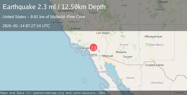
A 2.3 magnitude earthquake struck on SOUTHERN CALIFORNIA, at Wed, 14 Jan 2026 07:27:14 GMT. Depth: 12.5km. Reviewed by SCSN seismologists, this minor quake occurred at a magnitude type of ml.
Magnitude
2.3
ml
Source
SCSN
Intensity
-
Agency Reports
1 Sources| Source | Magnitude | Depth | Time |
|---|---|---|---|
| SCSNPrimary | 2.3 | 13 km | 1 month ago |
Earthquake Details
AutomaticEvent IDemsc_SCSN_20260114_0000078
Tsunami PotentialNo
Magnitude Typeml
Nearest Places
- Cinco Poses Spring0.4 km
- Boulder Basin Group0.6 km
- Black Mountain0.9 km
- Black Mountain Camp1.0 km
- Black Mountain Group Campground1.0 km
Comments
Join the discussion about this event.
Latest Earthquakes
2.5Mag
British Columbia, Canada
Time1 minute ago
Depth0.00 km
SourceVYT (Automatic)
3.4Mag
San Juan, Argentina
Time8 minutes ago
Depth10.00 km
SourceVYT (Automatic)
3.0Mag
Potosi, Bolivia
Time10 minutes ago
Depth269.04 km
SourceVYT (Automatic)
2.4Mag
Central Alaska
Time12 minutes ago
Depth0.24 km
SourceVYT (Automatic)
3.7Mag
Seram, Indonesia
Time12 minutes ago
Depth0.00 km
SourceVYT (Automatic)
Nearby Earthquakes
1.4Mag
6 km SSE of Cabazon, CA
Time1 week ago
Depth16.43 km
SourceUSGS (Automatic)
1.3Mag
5 km S of Cabazon, CA
Time4 hours ago
Depth5.80 km
SourceUSGS (Automatic)
3.0Mag
SOUTHERN CALIFORNIA
Time3 years ago
Depth10.00 km
SourceNEIC (Automatic)
2.1Mag
9 km WSW of Garnet, CA
Time3 weeks ago
Depth16.09 km
SourceUSGS (Automatic)
1.5Mag
3 km SW of Idyllwild, CA
Time3 weeks ago
Depth18.01 km
SourceUSGS (Automatic)