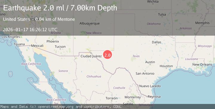
Earthquake WESTERN TEXAS
Sat, 17 Jan 2026 16:26:12 GMT
Time1 month ago
Location
31.5350, -104.0170
Depth
7.0 KM
Event Summary
A 2.0 magnitude earthquake struck on WESTERN TEXAS, at Sat, 17 Jan 2026 16:26:12 GMT. Depth: 7km. Reviewed by TX seismologists, this minor quake occurred at a magnitude type of ml.
Magnitude
2.0
ml
Source
TX
Intensity
-
Agency Reports
1 Sources| Source | Magnitude | Depth | Time |
|---|---|---|---|
| TXPrimary | 2.0 | 7 km | 1 month ago |
Earthquake Details
AutomaticEvent IDemsc_TX_20260117_0000317
Tsunami PotentialNo
Magnitude Typeml
Nearest Places
- Dry Lake3.0 km
- Juan Windmill3.1 km
- Lynn Tank5.6 km
- Dutch Draw5.7 km
- Rabbit Tank6.9 km
Comments
Join the discussion about this event.
Latest Earthquakes
2.8Mag
Fox Islands, Aleutian Islands, Alaska
Time3 minutes ago
Depth80.44 km
SourceVYT (Automatic)
0.9Mag
110 km S of McCarthy, Alaska
Time6 minutes ago
Depth18.50 km
SourceUSGS (Automatic)
3.0Mag
Central Alaska
Time6 minutes ago
Depth0.12 km
SourceVYT (Automatic)
2.5Mag
Minahassa Peninsula, Sulawesi
Time7 minutes ago
Depth4.95 km
SourceBMKG
2.9Mag
Minahasa, Sulawesi, Indonesia
Time7 minutes ago
Depth10.86 km
SourceVYT (Automatic)
Nearby Earthquakes
2.4Mag
WESTERN TEXAS
Time1 month ago
Depth7.30 km
SourceTX (Automatic)
2.3Mag
WESTERN TEXAS
Time1 month ago
Depth6.10 km
SourceTX (Automatic)
3.2Mag
WESTERN TEXAS
Time1 month ago
Depth7.80 km
SourceTX (Automatic)
2.8Mag
WESTERN TEXAS
Time1 month ago
Depth6.80 km
SourceTX (Automatic)
2.9Mag
WESTERN TEXAS
Time6 days ago
Depth7.30 km
SourceTX (Automatic)