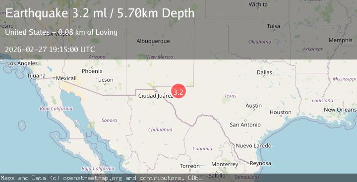
Earthquake WESTERN TEXAS
Fri, 27 Feb 2026 19:15:00 GMT
Time13 hours ago
Location
31.6560, -104.3970
Depth
5.7 KM
Event Summary
A 3.1 magnitude earthquake struck on WESTERN TEXAS, at Fri, 27 Feb 2026 19:15:00 GMT. Depth: 5.7km. Reviewed by TX seismologists, this minor quake occurred at a magnitude type of ml.
Magnitude
3.1
ml
Source
TX
Intensity
-
Agency Reports
2 Sources| Source | Magnitude | Depth | Time |
|---|---|---|---|
| TXPrimary | 3.1 | 6 km | 13 hours ago |
| USGS | 3.1 | 6 km | 13 hours ago |
Earthquake Details
AutomaticEvent IDemsc_TX_20260227_0000279
Tsunami PotentialNo
Magnitude Typeml
Nearest Places
- 1.1 km
- 3.0 km
- 3.6 km
- 4.2 km
- 4.8 km
Comments
Join the discussion about this event.
Latest Earthquakes
3.4Mag
Molucca Sea
Time13 hours ago
Depth37.84 km
SourceVYT (Automatic)
1.3Mag
Southeastern Alaska
Time13 hours ago
Depth3.78 km
SourceVYT (Automatic)
1.3Mag
CENTRAL TURKEY
Time13 hours ago
Depth7.00 km
SourceAFAD (Automatic)
2.3Mag
Sulawesi, Indonesia
Time13 hours ago
Depth23.19 km
SourceVYT (Automatic)
2.6Mag
EASTERN KASHMIR
Time13 hours ago
Depth15.20 km
SourceNDI (Automatic)
Nearby Earthquakes
1.4Mag
57 km S of Whites City, New Mexico
Time3 days ago
Depth0.00 km
SourceUSGS (Automatic)
3.0Mag
WESTERN TEXAS
Time3 years ago
Depth7.00 km
SourceTX (Automatic)
3.0Mag
WESTERN TEXAS
Time3 years ago
Depth7.00 km
SourceTX (Automatic)
3.0Mag
WESTERN TEXAS
Time2 years ago
Depth5.00 km
SourceNEIC (Automatic)
3.0Mag
WESTERN TEXAS
Time2 years ago
Depth6.80 km
SourceNEIC (Automatic)