Earthquake MYANMAR-INDIA BORDER REGION
Tue, 21 Apr 2026 17:01:32 GMT
Time1 week ago
Location
24.5390, 94.3160
Depth
68.0 KM
Event Summary
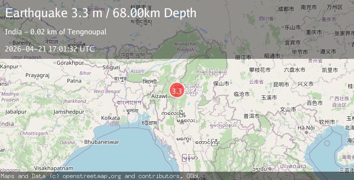
A 3.3 magnitude earthquake struck on MYANMAR-INDIA BORDER REGION, at Tue, 21 Apr 2026 17:01:32 GMT. Depth: 68km. Reviewed by NDI seismologists, this minor quake occurred at a magnitude type of m.
Magnitude
3.3
m
Source
NDI
Intensity
I
Agency Reports
1 Sources| Source | Magnitude | Depth | Time |
|---|---|---|---|
| NDIPrimary | 3.3 | 68 km | 1 week ago |
Earthquake Details
AutomaticEvent IDemsc_ndi_20260421_0000297
QualityS
Tsunami PotentialNo
Magnitude Typem
Last Update1 week ago
Nearest Places
Possibly felt by: 23.4K
- 24.1 km
- 26.1 km7.5K people
- 31.2 km8.8K people
- 34.2 km30.4K people
- 34.2 km44.5K people
- 39.2 km
- 40.8 km
- 43.9 km22.2K people
- 48.0 km223.5K people
Felt Reports0
Did you feel this earthquake? Report it to help others.
No reports yet
Be the first to report this earthquake!
Latest Earthquakes
Loading...
Nearby Earthquakes
3.3Mag
MYANMAR-INDIA BORDER REGION
Time2 days ago
Depth110.00 km
SourceNDI (Automatic)
3.4Mag
Myanmar-India border region
Time2 days ago
Depth124.27 km
SourceVYT (Automatic)
3.0Mag
MYANMAR
Time2 days ago
Depth80.00 km
SourceNDI (Automatic)
3.6Mag
Myanmar
Time4 days ago
Depth107.42 km
SourceVYT (Automatic)
3.4Mag
Myanmar-India border region
Time5 days ago
Depth10.00 km
SourceVYT (Automatic)