Earthquake MYANMAR
Mon, 23 Mar 2026 17:27:41 GMT
Time6 days ago
Location
25.1620, 95.1849
Depth
109.9 KM
Event Summary
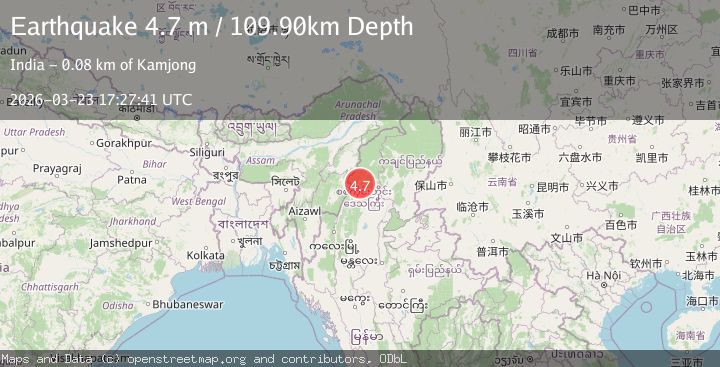
A 4.7 magnitude earthquake struck on MYANMAR, at Mon, 23 Mar 2026 17:27:41 GMT. Depth: 109.9km. Reviewed by NEIC seismologists, this light quake occurred at a magnitude type of m.
Magnitude
4.7
m
Source
NEIC
Intensity
II
Agency Reports
2 Sources| Source | Magnitude | Depth | Time |
|---|---|---|---|
| NEICPrimary | 4.7 | 110 km | 6 days ago |
| EMSC | 4.2 | 116 km | 6 days ago |
Earthquake Details
AutomaticEvent IDemsc_neic_20260323_0000310
QualityS
Tsunami PotentialNo
Magnitude Typem
Last Update6 days ago
Nearest Places
Possibly felt by: 196.8K
- IIKamjong75.4 km
- IIPhek88.8 km15.1K people
- 111.8 km29.5K people
- IIKohīma122.0 km92.1K people
- 122.1 km
- IIYairipok126.7 km8.8K people
- IITuensang128.1 km33.7K people
- IIWāngjing129.8 km7.5K people
- IIImphāl131.1 km223.5K people
- IIThoubāl133.2 km44.5K people
- 135.8 km
- 139.4 km54K people
- 142.1 km30.4K people
- 144.4 km22.2K people
- 145.5 km34K people
Felt Reports0
Did you feel this earthquake? Report it to help others.
No reports yet
Be the first to report this earthquake!
Latest Earthquakes
Loading...
Nearby Earthquakes
3.5Mag
MYANMAR
Time16 hours ago
Depth10.00 km
SourceNDI (Automatic)
4.3Mag
MYANMAR
Time1 day ago
Depth110.00 km
SourceNDI (Automatic)
4.5Mag
MYANMAR
Time2 weeks ago
Depth85.30 km
SourceGFZ (Automatic)
3.6Mag
MYANMAR
Time3 weeks ago
Depth113.00 km
SourceNDI (Automatic)
3.2Mag
MYANMAR-INDIA BORDER REGION
Time3 weeks ago
Depth90.00 km
SourceNDI (Automatic)