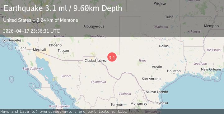
Earthquake WESTERN TEXAS
Fri, 17 Apr 2026 23:56:31 GMT
Time1 week ago
Location
31.7305, -104.0723
Depth
9.6 KM
Event Summary
A 3.1 magnitude earthquake struck on WESTERN TEXAS, at Fri, 17 Apr 2026 23:56:31 GMT. Depth: 9.6km. Reviewed by NEIC seismologists, this minor quake occurred at a magnitude type of ml.
Magnitude
3.1
ml
Source
NEIC
Intensity
I
Agency Reports
3 Sources| Source | Magnitude | Depth | Time |
|---|---|---|---|
| NEICPrimary | 3.1 | 10 km | 1 week ago |
| USGS | 3.2 | 8 km | 1 week ago |
| TX | 3.2 | 8 km | 1 week ago |
Earthquake Details
AutomaticEvent IDemsc_neic_20260417_0000345
QualityS
Tsunami PotentialNo
Magnitude Typeml
Last Update1 week ago
Used Stations40
Felt Reports0
Did you feel this earthquake? Report it to help others.
No reports yet
Be the first to report this earthquake!
Latest Earthquakes
Loading...
Nearby Earthquakes
1.6Mag
14 km SSW of Lindsay, Texas
Time42 minutes ago
Depth1.46 km
SourceUSGS (Automatic)
1.4Mag
western Texas
Time1 hour ago
Depth33.08 km
SourceVYT (Automatic)
1.7Mag
62 km WNW of Toyah, Texas
Time3 hours ago
Depth3.99 km
SourceUSGS (Automatic)
1.6Mag
61 km WNW of Toyah, Texas
Time3 hours ago
Depth4.51 km
SourceUSGS (Automatic)
1.9Mag
15 km SSW of Whites City, New Mexico
Time5 hours ago
Depth0.00 km
SourceUSGS (Automatic)