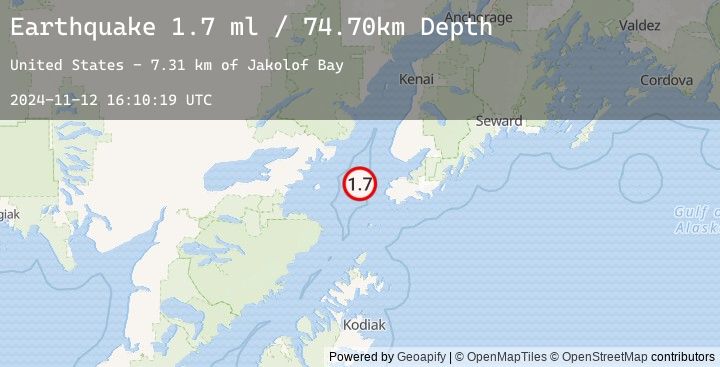
Earthquake 33 km W of Nanwalek, Alaska
Tue, 12 Nov 2024 16:10:19 GMT
Time
1 year ago
Location
59.4037, -152.4969
Depth
74.7 KM
Event Summary
A 1.7 magnitude earthquake struck on 33 km W of Nanwalek, Alaska, at Tue, 12 Nov 2024 16:10:19 GMT. Depth: 74.7km. Reviewed by USGS seismologists, this minor quake occurred at a magnitude type of ml.
Magnitude
1.7
ml
Source
USGS
Intensity
-
Earthquake Details
AutomaticEvent IDusgs_ak024ekiy4x6
Tsunami PotentialNo
Magnitude Typeml
Nearest Places
- Jakolof Bay7.3 km
- Flat Island Light29.6 km
- Flat Islands29.7 km
- Magnet Rock29.8 km
- Point Bede30.5 km
Comments
Join the discussion about this event.
Latest Earthquakes
2.8Mag
South of Java, Indonesia
Time
5 minutes ago
Depth15.94 km
SourceBMKG (Automatic)
4.7Mag
Northern Molucca Sea
Time
8 minutes ago
Depth47.87 km
SourceBMKG (Automatic)
4.4Mag
Timor Region
Time
15 minutes ago
Depth10.00 km
SourceBMKG (Automatic)
4.4Mag
EAST TIMOR REGION
Time
15 minutes ago
Depth10.00 km
SourceEMSC (Automatic)
4.4Mag
Banda Sea
Time
16 minutes ago
Depth521.93 km
SourceBMKG (Automatic)