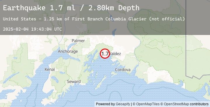
Earthquake 37 km NW of Tatitlek, Alaska
Tue, 04 Feb 2025 19:43:04 GMT
Time
10 months ago
Location
61.1329, -147.0935
Depth
2.8 KM
Event Summary
A 1.7 magnitude earthquake struck on 37 km NW of Tatitlek, Alaska, at Tue, 04 Feb 2025 19:43:04 GMT. Depth: 2.8km. Reviewed by USGS seismologists, this minor quake occurred at a magnitude type of ml.
Magnitude
1.7
ml
Source
USGS
Intensity
-
Earthquake Details
AutomaticEvent IDusgs_ak0251m7dlxh
Tsunami PotentialNo
Magnitude Typeml
Nearest Places
- First Branch Columbia Glacier (not official)1.2 km
- Great Nunatak5.1 km
- Kadin Lake5.9 km
- Terentiev Lake11.3 km
- Pedro Glacier11.8 km
Comments
Join the discussion about this event.
Latest Earthquakes
Nearby Earthquakes
No significant earthquakes nearby recently.