Earthquake 26 km WNW of Four Mile Road, Alaska
Wed, 19 Feb 2025 14:16:36 GMT
Time
9 months ago
Location
64.6981, -149.6188
Depth
27.1 KM
Event Summary
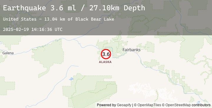
A 3.6 magnitude earthquake struck on 26 km WNW of Four Mile Road, Alaska, at Wed, 19 Feb 2025 14:16:36 GMT. Depth: 27.1km. Reviewed by USGS seismologists, this minor quake occurred at a magnitude type of ml.
Magnitude
3.6
ml
Source
USGS
Intensity
-
Earthquake Details
AutomaticEvent IDusgs_ak0252axaxek
Tsunami PotentialNo
Magnitude Typeml
Nearest Places
- Black Bear Lake13.0 km
- Caribou Crossing14.1 km
- Rock Creek17.0 km
- Henteel Dokaak'et17.7 km
- Kantishna River17.9 km
Comments
Join the discussion about this event.
Latest Earthquakes
2.1Mag
Timor Region
Time
4 minutes ago
Depth10.00 km
SourceBMKG (Automatic)
2.3Mag
Sulawesi, Indonesia
Time
7 minutes ago
Depth19.58 km
SourceBMKG (Automatic)
2.8Mag
Northern Molucca Sea
Time
19 minutes ago
Depth195.30 km
SourceBMKG (Automatic)
2.2Mag
Sumbawa Region, Indonesia
Time
20 minutes ago
Depth212.77 km
SourceBMKG (Automatic)
3.4Mag
Near North Coast of West Papua
Time
25 minutes ago
Depth19.44 km
SourceBMKG (Automatic)
Nearby Earthquakes
No significant earthquakes nearby recently.