Earthquake 33 km SW of Nanwalek, Alaska
Thu, 01 Jan 2026 10:06:59 GMT
Time1 hour ago
Location
59.1830, -152.4050
Depth
62.9 KM
Event Summary
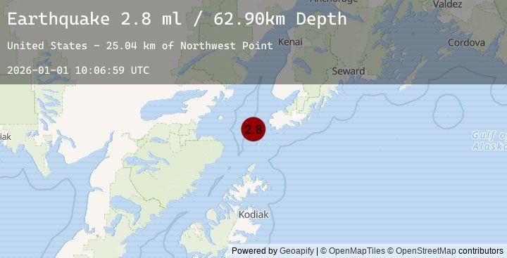
A 2.8 magnitude earthquake struck on 33 km SW of Nanwalek, Alaska, at Thu, 01 Jan 2026 10:06:59 GMT. Depth: 62.9km. Reviewed by USGS seismologists, this minor quake occurred at a magnitude type of ml.
Magnitude
2.8
ml
Source
USGS
Intensity
-
Earthquake Details
AutomaticEvent IDusgs_ak2026aaudbq
Tsunami PotentialNo
Magnitude Typeml
Nearest Places
- Northwest Point25.0 km
- Point Adam25.8 km
- Magnet Rock26.7 km
- Cook Inlet27.3 km
- Koyuktolik Bay27.6 km
Comments
Join the discussion about this event.
Latest Earthquakes
1.2Mag
3 km ENE of Badger, Alaska
Time4 minutes ago
Depth3.90 km
SourceUSGS (Automatic)
3.7Mag
Java, Indonesia
Time5 minutes ago
Depth26.68 km
SourceBMKG (Automatic)
1.0Mag
11 km WSW of Salton City, CA
Time10 minutes ago
Depth4.47 km
SourceUSGS (Automatic)
2.3Mag
Java, Indonesia
Time21 minutes ago
Depth58.10 km
SourceBMKG (Automatic)
2.8Mag
JAVA, INDONESIA
Time21 minutes ago
Depth41.00 km
SourceEMSC (Automatic)
Nearby Earthquakes
2.1Mag
60 km ENE of Pedro Bay, Alaska
Time2 hours ago
Depth127.30 km
SourceUSGS (Automatic)
1.9Mag
43 km WSW of Anchor Point, Alaska
Time10 hours ago
Depth71.10 km
SourceUSGS (Automatic)
4.0Mag
SOUTHERN ALASKA
Time15 hours ago
Depth101.20 km
SourceEMSC (Automatic)
3.7Mag
62 km W of Happy Valley, Alaska
Time15 hours ago
Depth116.10 km
SourceUSGS (Automatic)
1.6Mag
49 km ENE of Pedro Bay, Alaska
Time19 hours ago
Depth140.00 km
SourceUSGS (Automatic)