Earthquake 65 km WNW of Nanwalek, Alaska
Sun, 04 Jan 2026 06:25:01 GMT
Time4 days ago
Location
59.5590, -153.0070
Depth
106.6 KM
Event Summary
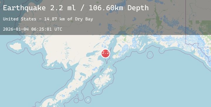
A 2.2 magnitude earthquake struck on 65 km WNW of Nanwalek, Alaska, at Sun, 04 Jan 2026 06:25:01 GMT. Depth: 106.6km. Reviewed by USGS seismologists, this minor quake occurred at a magnitude type of ml.
Magnitude
2.2
ml
Source
USGS
Intensity
-
Agency Reports
1 Sources| Source | Magnitude | Depth | Time |
|---|---|---|---|
| USGSPrimary | 2.2 | 107 km | 4 days ago |
Earthquake Details
AutomaticEvent IDusgs_ak2026afzynp
Tsunami PotentialNo
Magnitude Typeml
Nearest Places
- Dry Bay14.8 km
- Chinitna Point15.1 km
- Knub Hill15.3 km
- Brown Creek15.4 km
- Oil Point15.9 km
Comments
Join the discussion about this event.
Latest Earthquakes
2.0Mag
WESTERN TEXAS
Time4 days ago
Depth6.00 km
SourceTX (Automatic)
2.1Mag
CENTRAL ITALY
Time4 days ago
Depth9.10 km
SourceINGV (Automatic)
3.3Mag
Southern Sumatra, Indonesia
Time4 days ago
Depth10.00 km
SourceBMKG (Automatic)
2.5Mag
ATACAMA, CHILE
Time4 days ago
Depth83.30 km
SourceCSN (Automatic)
1.4Mag
WESTERN TURKEY
Time4 days ago
Depth7.30 km
SourceAFAD (Automatic)
Nearby Earthquakes
0.4Mag
68 km E of Port Alsworth, Alaska
Time4 days ago
Depth5.60 km
SourceUSGS (Automatic)
2.2Mag
67 km WNW of Happy Valley, Alaska
Time4 days ago
Depth128.90 km
SourceUSGS (Automatic)
0.3Mag
79 km ENE of Port Alsworth, Alaska
Time4 days ago
Depth24.60 km
SourceUSGS (Automatic)
2.3Mag
7 km NNW of Nikolaevsk, Alaska
Time5 days ago
Depth45.20 km
SourceUSGS (Automatic)
0.7Mag
62 km E of Port Alsworth, Alaska
Time5 days ago
Depth5.00 km
SourceUSGS (Automatic)