Earthquake 19 km ESE of Skwentna, Alaska
Mon, 05 Jan 2026 15:16:31 GMT
Time3 days ago
Location
61.9110, -151.0610
Depth
68.7 KM
Event Summary
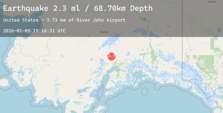
A 2.3 magnitude earthquake struck on 19 km ESE of Skwentna, Alaska, at Mon, 05 Jan 2026 15:16:31 GMT. Depth: 68.7km. Reviewed by USGS seismologists, this minor quake occurred at a magnitude type of ml.
Magnitude
2.3
ml
Source
USGS
Intensity
-
Agency Reports
1 Sources| Source | Magnitude | Depth | Time |
|---|---|---|---|
| USGSPrimary | 2.3 | 69 km | 3 days ago |
Earthquake Details
AutomaticEvent IDusgs_ak2026ainhhr
Tsunami PotentialNo
Magnitude Typeml
Nearest Places
- River John Airport3.7 km
- Fish Lake Creek5.5 km
- Eightmile Creek5.6 km
- Bottle Creek5.9 km
- Ch'atanil'ut7.3 km
Comments
Join the discussion about this event.
Latest Earthquakes
1.8Mag
19 km SSE of Pāhala, Hawaii
Time3 days ago
Depth35.46 km
SourceUSGS (Automatic)
2.8Mag
ANTOFAGASTA, CHILE
Time3 days ago
Depth124.40 km
SourceCSN (Automatic)
3.7Mag
Flores Sea
Time3 days ago
Depth5.00 km
SourceBMKG (Automatic)
2.7Mag
Flores Region, Indonesia
Time3 days ago
Depth163.63 km
SourceBMKG (Automatic)
1.3Mag
EASTERN TURKEY
Time3 days ago
Depth7.60 km
SourceAFAD (Automatic)
Nearby Earthquakes
2.4Mag
14 km SSE of Susitna North, Alaska
Time3 days ago
Depth34.10 km
SourceUSGS (Automatic)
1.7Mag
6 km NNW of Meadow Lakes, Alaska
Time3 days ago
Depth34.50 km
SourceUSGS (Automatic)
2.0Mag
5 km W of Beluga, Alaska
Time3 days ago
Depth67.10 km
SourceUSGS (Automatic)
1.9Mag
13 km WSW of Petersville, Alaska
Time3 days ago
Depth80.40 km
SourceUSGS (Automatic)