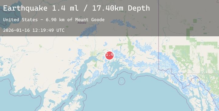
Earthquake 45 km ESE of Knik River, Alaska
Fri, 16 Jan 2026 12:19:49 GMT
Time1 hour ago
Location
61.3120, -148.1110
Depth
17.4 KM
Event Summary
A 1.4 magnitude earthquake struck on 45 km ESE of Knik River, Alaska, at Fri, 16 Jan 2026 12:19:49 GMT. Depth: 17.4km. Reviewed by USGS seismologists, this minor quake occurred at a magnitude type of ml.
Magnitude
1.4
ml
Source
USGS
Intensity
-
Agency Reports
1 Sources| Source | Magnitude | Depth | Time |
|---|---|---|---|
| USGSPrimary | 1.4 | 17 km | 1 hour ago |
Earthquake Details
AutomaticEvent IDusgs_ak2026bcmksv
Tsunami PotentialNo
Magnitude Typeml
Nearest Places
- Mount Goode6.9 km
- Mount Gannett8.9 km
- Gannett Glacier10.0 km
- Barry Glacier11.7 km
- Knik Glacier11.8 km
Comments
Join the discussion about this event.
Latest Earthquakes
1.4Mag
12 km ESE of Willits, CA
Time9 minutes ago
Depth7.21 km
SourceUSGS (Automatic)
2.5Mag
Sumbawa Region, Indonesia
Time10 minutes ago
Depth11.46 km
SourceBMKG (Automatic)
2.9Mag
Java, Indonesia
Time19 minutes ago
Depth21.57 km
SourceBMKG (Automatic)
0.6Mag
38 km NNE of Amboy, Washington
Time24 minutes ago
Depth0.23 km
SourceUSGS
2.9Mag
Flores Sea
Time25 minutes ago
Depth282.44 km
SourceBMKG (Automatic)
Nearby Earthquakes
No significant earthquakes nearby recently.