Earthquake 39 km N of Glacier View, Alaska
Tue, 27 Jan 2026 19:32:47 GMT
Time5 hours ago
Location
62.1620, -147.7660
Depth
36.2 KM
Event Summary
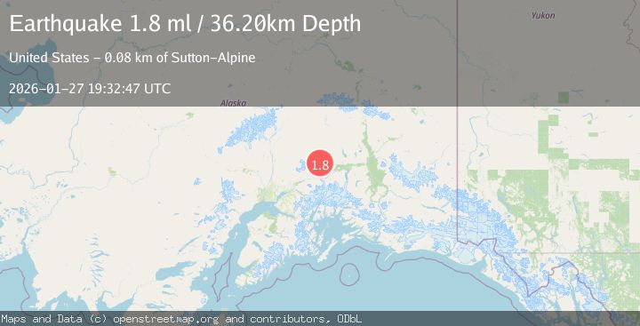
A 1.8 magnitude earthquake struck on 39 km N of Glacier View, Alaska, at Tue, 27 Jan 2026 19:32:47 GMT. Depth: 36.2km. Reviewed by USGS seismologists, this minor quake occurred at a magnitude type of ml.
Magnitude
1.8
ml
Source
USGS
Intensity
-
Agency Reports
1 Sources| Source | Magnitude | Depth | Time |
|---|---|---|---|
| USGSPrimary | 1.8 | 36 km | 5 hours ago |
Earthquake Details
AutomaticEvent IDusgs_ak2026bxftks
Tsunami PotentialNo
Magnitude Typeml
Nearest Places
- Horsepasture Creek7.9 km
- Horsepasture Pass8.2 km
- Cardioceras Creek8.5 km
- Cardiceras Creek8.6 km
- Cadoceras Creek8.9 km
Comments
Join the discussion about this event.
Latest Earthquakes
2.8Mag
63 km SE of Denali National Park, Alaska
Time6 minutes ago
Depth123.60 km
SourceUSGS (Automatic)
3.9Mag
West Papua Region, Indonesia
Time8 minutes ago
Depth17.51 km
SourceBMKG (Automatic)
1.5Mag
6 km W of Holtville, CA
Time9 minutes ago
Depth8.56 km
SourceUSGS (Automatic)
1.6Mag
2 km NW of The Geysers, CA
Time9 minutes ago
Depth1.46 km
SourceUSGS (Automatic)
2.3Mag
Flores Region, Indonesia
Time11 minutes ago
Depth105.89 km
SourceBMKG (Automatic)
Nearby Earthquakes
2.6Mag
38 km NNE of Chickaloon, Alaska
Time2 days ago
Depth20.00 km
SourceUSGS (Automatic)
1.5Mag
15 km WNW of Eureka Roadhouse, Alaska
Time1 day ago
Depth31.90 km
SourceUSGS
1.5Mag
20 km SE of Chickaloon, Alaska
Time2 days ago
Depth15.40 km
SourceUSGS (Automatic)
1.8Mag
36 km NNW of Sutton-Alpine, Alaska
Time3 days ago
Depth37.60 km
SourceUSGS (Automatic)
1.5Mag
32 km S of Eureka Roadhouse, Alaska
Time3 days ago
Depth19.10 km
SourceUSGS (Automatic)