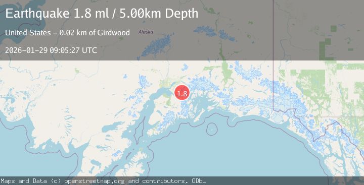
Earthquake 17 km NE of Girdwood, Alaska
Thu, 29 Jan 2026 09:05:27 GMT
Time1 hour ago
Location
61.0440, -148.9110
Depth
5.0 KM
Event Summary
A 1.8 magnitude earthquake struck on 17 km NE of Girdwood, Alaska, at Thu, 29 Jan 2026 09:05:27 GMT. Depth: 5km. Reviewed by USGS seismologists, this minor quake occurred at a magnitude type of ml.
Magnitude
1.8
ml
Source
USGS
Intensity
-
Agency Reports
1 Sources| Source | Magnitude | Depth | Time |
|---|---|---|---|
| USGSPrimary | 1.8 | 5 km | 1 hour ago |
Earthquake Details
AutomaticEvent IDusgs_ak2026cackrl
Tsunami PotentialNo
Magnitude Typeml
Nearest Places
- Eagle Glacier6.0 km
- Goat Mountain7.5 km
- Glenn Lake7.5 km
- Raven Glacier9.2 km
- Summit Mountain9.2 km
Comments
Join the discussion about this event.
Latest Earthquakes
2.1Mag
FRANCE
Time6 minutes ago
Depth0.00 km
SourceReNaSS (Automatic)
2.2Mag
Minahassa Peninsula, Sulawesi
Time8 minutes ago
Depth242.30 km
SourceBMKG (Automatic)
2.2Mag
FRANCE
Time21 minutes ago
Depth5.00 km
SourceReNaSS (Automatic)
2.1Mag
OKLAHOMA
Time28 minutes ago
Depth4.00 km
SourceOK (Automatic)
3.5Mag
SOUTHERN ALASKA
Time28 minutes ago
Depth21.80 km
SourceAK (Automatic)
Nearby Earthquakes
1.1Mag
9 km NE of Girdwood, Alaska
Time4 days ago
Depth31.40 km
SourceUSGS (Automatic)
1.3Mag
7 km NW of Girdwood, Alaska
Time4 days ago
Depth34.60 km
SourceUSGS (Automatic)
2.6Mag
6 km SSW of Girdwood, Alaska
Time3 days ago
Depth24.40 km
SourceUSGS (Automatic)
2.5Mag
5 km SE of Elmendorf Air Force Base, Alaska
Time5 days ago
Depth39.60 km
SourceUSGS (Automatic)
1.6Mag
54 km NE of Whittier, Alaska
Time5 days ago
Depth5.00 km
SourceUSGS (Automatic)