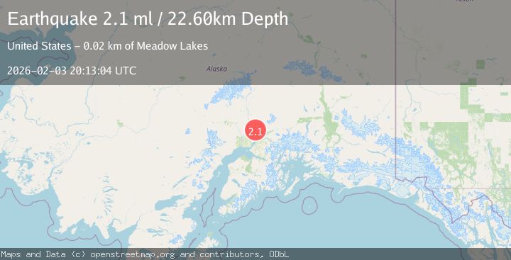
Earthquake 16 km NNW of Meadow Lakes, Alaska
Tue, 03 Feb 2026 20:13:04 GMT
Time20 hours ago
Location
61.7720, -149.6730
Depth
22.6 KM
Event Summary
A 2.1 magnitude earthquake struck on 16 km NNW of Meadow Lakes, Alaska, at Tue, 03 Feb 2026 20:13:04 GMT. Depth: 22.6km. Reviewed by USGS seismologists, this minor quake occurred at a magnitude type of ml.
Magnitude
2.1
ml
Source
USGS
Intensity
-
Agency Reports
1 Sources| Source | Magnitude | Depth | Time |
|---|---|---|---|
| USGSPrimary | 2.1 | 23 km | 20 hours ago |
Earthquake Details
AutomaticEvent IDusgs_ak2026ckdejv
Tsunami PotentialNo
Magnitude Typeml
Nearest Places
- Twelvemile Lake2.6 km
- Peters Creek3.0 km
- Canyon Creek4.5 km
- Teakwood Lake5.3 km
- Purches Creek5.5 km
Comments
Join the discussion about this event.
Latest Earthquakes
1.1Mag
14 km ENE of Fox, Alaska
Time20 hours ago
Depth5.80 km
SourceUSGS (Automatic)
3.3Mag
OFFSHORE GUATEMALA
Time21 hours ago
Depth85.00 km
SourceINET (Automatic)
2.0Mag
32 km SSE of Goodsprings, Nevada
Time21 hours ago
Depth13.94 km
SourceUSGS (Automatic)
1.7Mag
25 km SSE of Denali National Park, Alaska
Time21 hours ago
Depth6.00 km
SourceUSGS (Automatic)
1.7Mag
3 km NW of The Geysers, CA
Time21 hours ago
Depth2.18 km
SourceUSGS (Automatic)
Nearby Earthquakes
2.1Mag
22 km ENE of Willow, Alaska
Time5 days ago
Depth41.80 km
SourceUSGS (Automatic)
2.0Mag
13 km ENE of Willow, Alaska
Time1 week ago
Depth26.90 km
SourceUSGS (Automatic)
1.7Mag
3 km SW of Houston, Alaska
Time1 week ago
Depth58.40 km
SourceUSGS (Automatic)
2.6Mag
7 km S of Willow, Alaska
Time1 week ago
Depth5.00 km
SourceUSGS (Automatic)
1.5Mag
7 km S of Willow, Alaska
Time1 week ago
Depth10.10 km
SourceUSGS (Automatic)