Earthquake 26 km SSW of Tanacross, Alaska
Sun, 15 Feb 2026 14:43:21 GMT
Time4 days ago
Location
63.1840, -143.6240
Depth
5.0 KM
Event Summary
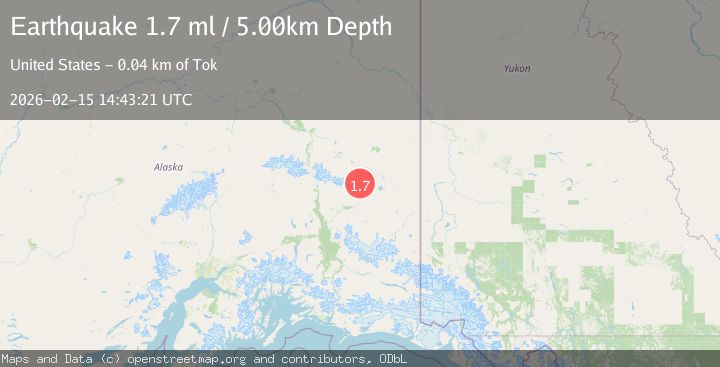
A 1.7 magnitude earthquake struck on 26 km SSW of Tanacross, Alaska, at Sun, 15 Feb 2026 14:43:21 GMT. Depth: 5km. Reviewed by USGS seismologists, this minor quake occurred at a magnitude type of ml.
Magnitude
1.7
ml
Source
USGS
Intensity
-
Agency Reports
1 Sources| Source | Magnitude | Depth | Time |
|---|---|---|---|
| USGSPrimary | 1.7 | 5 km | 4 days ago |
Earthquake Details
AutomaticEvent IDusgs_ak2026dfsyuz
Tsunami PotentialNo
Magnitude Typeml
Nearest Places
- Dry Tok Creek4.8 km
- Natohona Creek5.0 km
- Timber Creek7.5 km
- Shindata Creek8.8 km
- White Creek8.8 km
Comments
Join the discussion about this event.
Latest Earthquakes
1.8Mag
Southeastern Alaska
Time4 minutes ago
Depth0.00 km
SourceVYT (Automatic)
2.6Mag
northern Alaska
Time5 minutes ago
Depth206.30 km
SourceVYT (Automatic)
3.4Mag
OFF W. COAST OF S. ISLAND, N.Z.
Time6 minutes ago
Depth5.00 km
SourceGNS (Automatic)
5.0Mag
HOKKAIDO, JAPAN REGION
Time12 minutes ago
Depth60.00 km
SourceEMSC (Automatic)
2.7Mag
Alaska Peninsula
Time17 minutes ago
Depth7.08 km
SourceVYT (Automatic)
Nearby Earthquakes
3.0Mag
CENTRAL ALASKA
Time1 year ago
Depth5.70 km
SourceNEIC (Automatic)
5.2Mag
CENTRAL ALASKA
Time20 years ago
Depth30.00 km
SourceEMSC (Automatic)
2.6Mag
Central Alaska
Time1 week ago
Depth0.00 km
SourceVYT (Automatic)
2.0Mag
Central Alaska
Time3 days ago
Depth2.08 km
SourceVYT (Automatic)
3.0Mag
CENTRAL ALASKA
Time8 years ago
Depth0.00 km
SourceNEIR (Automatic)