Earthquake 9 km NE of Perryville, Alaska
Mon, 16 Feb 2026 04:32:18 GMT
Time2 days ago
Location
55.9670, -159.0360
Depth
17.4 KM
Event Summary
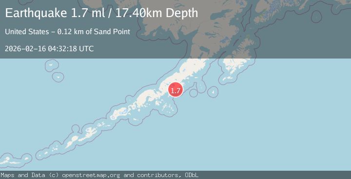
A 1.7 magnitude earthquake struck on 9 km NE of Perryville, Alaska, at Mon, 16 Feb 2026 04:32:18 GMT. Depth: 17.4km. Reviewed by USGS seismologists, this minor quake occurred at a magnitude type of ml.
Magnitude
1.7
ml
Source
USGS
Intensity
-
Agency Reports
1 Sources| Source | Magnitude | Depth | Time |
|---|---|---|---|
| USGSPrimary | 1.7 | 17 km | 2 days ago |
Earthquake Details
AutomaticEvent IDusgs_ak2026dgulec
Tsunami PotentialNo
Magnitude Typeml
Nearest Places
- Red Bluff Mountain3.8 km
- Red Bluff Creek4.8 km
- Kametolook River5.4 km
- Anchor Bay6.6 km
- Perryville Alaska Native Village Statistical Area7.8 km
Comments
Join the discussion about this event.
Latest Earthquakes
1.9Mag
Southern Alaska
Time16 hours ago
Depth0.00 km
SourceVYT (Automatic)
2.5Mag
Antofagasta, Chile
Time16 hours ago
Depth111.21 km
SourceVYT (Automatic)
2.8Mag
Tarapaca, Chile
Time16 hours ago
Depth89.11 km
SourceVYT (Automatic)
2.5Mag
LA RIOJA, ARGENTINA
Time16 hours ago
Depth124.00 km
SourceNSNA (Automatic)
1.8Mag
Central Alaska
Time16 hours ago
Depth0.00 km
SourceVYT (Automatic)
Nearby Earthquakes
5.0Mag
ALASKA PENINSULA
Time7 years ago
Depth60.00 km
SourceEMSC (Automatic)
1.3Mag
14 km N of Ivanof Bay, Alaska
Time1 day ago
Depth5.00 km
SourceUSGS (Automatic)
3.0Mag
ALASKA PENINSULA
Time1 year ago
Depth55.00 km
SourceNEIC (Automatic)
5.0Mag
ALASKA PENINSULA
Time7 years ago
Depth20.00 km
SourceEMSC (Automatic)
3.0Mag
ALASKA PENINSULA
Time8 years ago
Depth46.00 km
SourceNEIR (Automatic)