Earthquake 85 km NW of Karluk, Alaska
Tue, 17 Feb 2026 23:11:04 GMT
Time13 hours ago
Location
58.1740, -155.3420
Depth
5.0 KM
Event Summary
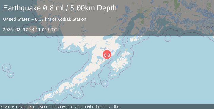
A 0.8 magnitude earthquake struck on 85 km NW of Karluk, Alaska, at Tue, 17 Feb 2026 23:11:04 GMT. Depth: 5km. Reviewed by USGS seismologists, this minor quake occurred at a magnitude type of ml.
Magnitude
0.8
ml
Source
USGS
Intensity
-
Agency Reports
1 Sources| Source | Magnitude | Depth | Time |
|---|---|---|---|
| USGSPrimary | 0.8 | 5 km | 13 hours ago |
Earthquake Details
AutomaticEvent IDusgs_ak2026dkbgcc
Tsunami PotentialNo
Magnitude Typeml
Nearest Places
- Mount Mageik5.7 km
- Mageik Landslide9.6 km
- Mount Cerberus11.5 km
- Katmai Pass11.8 km
- Observation Mountain12.4 km
Comments
Join the discussion about this event.
Latest Earthquakes
2.6Mag
Antofagasta, Chile
Time1 minute ago
Depth67.26 km
SourceVYT (Automatic)
1.8Mag
northern Alaska
Time3 minutes ago
Depth223.88 km
SourceVYT (Automatic)
3.0Mag
Java, Indonesia
Time4 minutes ago
Depth29.78 km
SourceBMKG
2.4Mag
Finland-Russia border region
Time5 minutes ago
Depth341.92 km
SourceVYT (Automatic)
0.9Mag
8 km W of Cobb, CA
Time10 minutes ago
Depth1.53 km
SourceUSGS (Automatic)
Nearby Earthquakes
2.0Mag
85 km NW of Karluk, Alaska
Time1 week ago
Depth5.00 km
SourceUSGS (Automatic)
1.0Mag
85 km NW of Karluk, Alaska
Time3 weeks ago
Depth5.00 km
SourceUSGS (Automatic)
0.4Mag
86 km NW of Karluk, Alaska
Time3 weeks ago
Depth5.00 km
SourceUSGS (Automatic)
1.3Mag
86 km NW of Karluk, Alaska
Time2 weeks ago
Depth5.00 km
SourceUSGS (Automatic)
0.8Mag
86 km NW of Karluk, Alaska
Time2 weeks ago
Depth5.00 km
SourceUSGS (Automatic)