Earthquake 45 km WNW of Mentasta Lake, Alaska
Tue, 24 Feb 2026 15:04:01 GMT
Time1 hour ago
Location
63.1230, -144.5410
Depth
9.7 KM
Event Summary
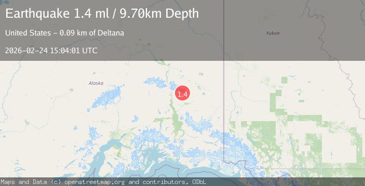
A 1.4 magnitude earthquake struck on 45 km WNW of Mentasta Lake, Alaska, at Tue, 24 Feb 2026 15:04:01 GMT. Depth: 9.7km. Reviewed by USGS seismologists, this minor quake occurred at a magnitude type of ml.
Magnitude
1.4
ml
Source
USGS
Intensity
-
Agency Reports
1 Sources| Source | Magnitude | Depth | Time |
|---|---|---|---|
| USGSPrimary | 1.4 | 10 km | 1 hour ago |
Earthquake Details
AutomaticEvent IDusgs_aka2026dwheob
Tsunami PotentialNo
Magnitude Typeml
Nearest Places
- 4.7 km
- 4.7 km
- 5.0 km
- 5.1 km
- 5.1 km
Comments
Join the discussion about this event.
Latest Earthquakes
1.5Mag
Southern California
Time2 minutes ago
Depth2.44 km
SourceVYT (Automatic)
2.7Mag
Sumbawa region, Indonesia
Time5 minutes ago
Depth93.87 km
SourceVYT (Automatic)
2.5Mag
Alaska Peninsula
Time8 minutes ago
Depth0.12 km
SourceVYT (Automatic)
3.8Mag
Banda Sea
Time9 minutes ago
Depth172.73 km
SourceVYT (Automatic)
2.8Mag
Minahasa, Sulawesi, Indonesia
Time12 minutes ago
Depth10.00 km
SourceVYT (Automatic)
Nearby Earthquakes
2.7Mag
CENTRAL ALASKA
Time1 month ago
Depth7.20 km
SourceNEIC (Automatic)
2.5Mag
CENTRAL ALASKA
Time1 month ago
Depth5.60 km
SourceNEIC (Automatic)
3.0Mag
CENTRAL ALASKA
Time8 years ago
Depth0.00 km
SourceNEIR (Automatic)
1.6Mag
Central Alaska
Time18 hours ago
Depth10.38 km
SourceVYT (Automatic)
2.3Mag
Central Alaska
Time1 week ago
Depth9.03 km
SourceVYT (Automatic)