Earthquake 15 km NNE of Aleneva, Alaska
Thu, 05 Mar 2026 13:16:03 GMT
Time2 hours ago
Location
58.1960, -152.8330
Depth
52.2 KM
Event Summary
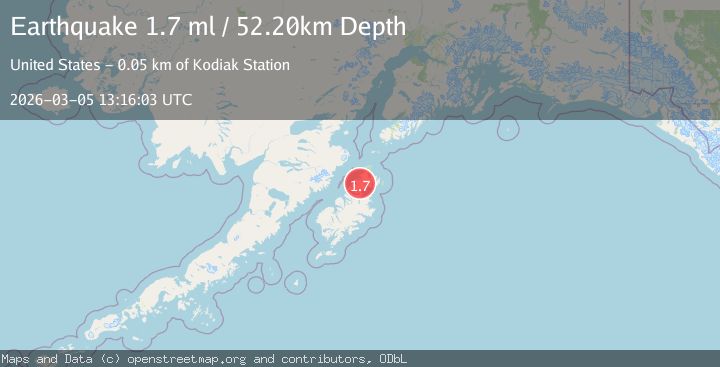
A 1.7 magnitude earthquake struck on 15 km NNE of Aleneva, Alaska, at Thu, 05 Mar 2026 13:16:03 GMT. Depth: 52.2km. Reviewed by USGS seismologists, this minor quake occurred at a magnitude type of ml.
Magnitude
1.7
ml
Source
USGS
Intensity
-
Agency Reports
1 Sources| Source | Magnitude | Depth | Time |
|---|---|---|---|
| USGSPrimary | 1.7 | 52 km | 2 hours ago |
Earthquake Details
AutomaticEvent IDusgs_aka2026emrdle
Tsunami PotentialNo
Magnitude Typeml
Nearest Places
- 4.0 km
- 8.5 km
- 8.8 km
- 9.9 km
- 10.0 km
Comments
Join the discussion about this event.
Latest Earthquakes
1.8Mag
Tarapaca, Chile
Time2 hours ago
Depth27.59 km
SourceVYT (Automatic)
3.4Mag
southern Sumatra, Indonesia
Time2 hours ago
Depth12.57 km
SourceVYT (Automatic)
2.3Mag
Sumbawa Region, Indonesia
Time3 hours ago
Depth10.00 km
SourceBMKG
0.4Mag
11 km NW of Anza, CA
Time3 hours ago
Depth13.43 km
SourceUSGS (Automatic)
2.3Mag
Southern Alaska
Time3 hours ago
Depth118.90 km
SourceVYT (Automatic)
Nearby Earthquakes
2.8Mag
Kodiak Island region, Alaska
Time3 weeks ago
Depth122.19 km
SourceVYT (Automatic)
2.0Mag
Kodiak Island region, Alaska
Time1 week ago
Depth84.11 km
SourceVYT (Automatic)
3.0Mag
KODIAK ISLAND REGION, ALASKA
Time8 years ago
Depth47.00 km
SourceNEIR (Automatic)
3.0Mag
KODIAK ISLAND REGION, ALASKA
Time8 years ago
Depth39.00 km
SourceNEIR (Automatic)
3.0Mag
KODIAK ISLAND REGION, ALASKA
Time9 years ago
Depth55.00 km
SourceNEIR (Automatic)