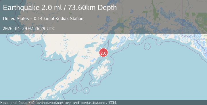
Earthquake 74 km SW of Nanwalek, Alaska
Wed, 29 Apr 2026 02:26:29 GMT
Time18 hours ago
Location
58.9850, -153.0110
Depth
73.6 KM
Event Summary
A 2.0 magnitude earthquake struck on 74 km SW of Nanwalek, Alaska, at Wed, 29 Apr 2026 02:26:29 GMT. Depth: 73.6km. Reviewed by USGS seismologists, this minor quake occurred at a magnitude type of ml.
Magnitude
2.0
ml
Source
USGS
Intensity
-
Agency Reports
1 Sources| Source | Magnitude | Depth | Time |
|---|---|---|---|
| USGSPrimary | 2.0 | 74 km | 18 hours ago |
Earthquake Details
AutomaticEvent IDusgs_aka2026iiuocg
QualityS
Tsunami PotentialNo
Magnitude Typeml
Last Update18 hours ago
Used Stations48
Felt Reports0
Did you feel this earthquake? Report it to help others.
No reports yet
Be the first to report this earthquake!
Latest Earthquakes
Loading...
Nearby Earthquakes
1.7Mag
47 km W of Nanwalek, Alaska
Time1 day ago
Depth70.10 km
SourceUSGS (Automatic)
1.5Mag
55 km W of Nanwalek, Alaska
Time1 day ago
Depth86.40 km
SourceUSGS (Automatic)
2.9Mag
Alaska Peninsula
Time1 day ago
Depth102.66 km
SourceVYT (Automatic)
1.8Mag
64 km WSW of Nanwalek, Alaska
Time2 days ago
Depth71.20 km
SourceUSGS (Automatic)
2.2Mag
93 km SE of Kokhanok, Alaska
Time2 days ago
Depth0.90 km
SourceUSGS (Automatic)