Earthquake 12 km WNW of Calipatria, CA
Fri, 20 Dec 2024 11:29:32 GMT
Time
11 months ago
Location
33.1772, -115.6207
Depth
3.4 KM
Event Summary
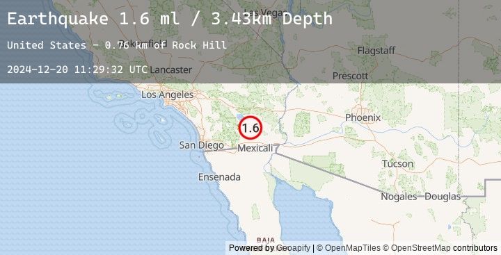
A 1.6 magnitude earthquake struck on 12 km WNW of Calipatria, CA, at Fri, 20 Dec 2024 11:29:32 GMT. Depth: 3.43km. Reviewed by USGS seismologists, this minor quake occurred at a magnitude type of ml.
Magnitude
1.6
ml
Source
USGS
Intensity
-
Earthquake Details
AutomaticEvent IDusgs_ci40825895
Tsunami PotentialNo
Magnitude Typeml
Nearest Places
- Rock Hill0.8 km
- Vail Lateral Four-A1.6 km
- Obsidian Butte1.7 km
- Pumice Drain1.8 km
- Vail Lateral Four1.9 km
Comments
Join the discussion about this event.
Latest Earthquakes
2.1Mag
Timor Region
Time
5 minutes ago
Depth10.00 km
SourceBMKG (Automatic)
2.3Mag
Sulawesi, Indonesia
Time
9 minutes ago
Depth19.58 km
SourceBMKG (Automatic)
2.8Mag
Northern Molucca Sea
Time
20 minutes ago
Depth195.30 km
SourceBMKG (Automatic)
2.2Mag
Sumbawa Region, Indonesia
Time
21 minutes ago
Depth212.77 km
SourceBMKG (Automatic)
3.4Mag
Near North Coast of West Papua
Time
26 minutes ago
Depth19.44 km
SourceBMKG (Automatic)
Nearby Earthquakes
No significant earthquakes nearby recently.