Earthquake 8 km NE of Banning, CA
Wed, 26 Mar 2025 09:17:52 GMT
Time8 months ago
Location
33.9858, -116.8277
Depth
13.7 KM
Event Summary
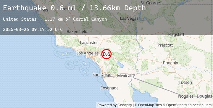
A 0.6 magnitude earthquake struck on 8 km NE of Banning, CA, at Wed, 26 Mar 2025 09:17:52 GMT. Depth: 13.66km. Reviewed by USGS seismologists, this minor quake occurred at a magnitude type of ml.
Magnitude
0.6
ml
Source
USGS
Intensity
-
Earthquake Details
AutomaticEvent IDusgs_ci40910615
Tsunami PotentialNo
Magnitude Typeml
Nearest Places
- Corral Canyon1.2 km
- Wood Canyon1.2 km
- Burro Flats2.5 km
- West Branch Millard Canyon3.1 km
- Morongo Moravian Church3.3 km
Comments
Join the discussion about this event.
Latest Earthquakes
2.4Mag
Bali Sea
Time1 day ago
Depth16.14 km
SourceBMKG (Automatic)
3.0Mag
Java, Indonesia
Time1 day ago
Depth31.55 km
SourceBMKG (Automatic)
3.0Mag
JAVA, INDONESIA
Time1 day ago
Depth39.00 km
SourceEMSC (Automatic)
2.3Mag
NEAR SOUTH COAST OF FRANCE
Time1 day ago
Depth5.00 km
SourceEMSC (Automatic)
3.4Mag
South of Java, Indonesia
Time1 day ago
Depth10.00 km
SourceBMKG (Automatic)