Earthquake 11 km NW of Progreso, B.C., MX
Sat, 20 Dec 2025 07:57:58 GMT
Time2 hours ago
Location
32.6588, -115.6595
Depth
9.5 KM
Event Summary
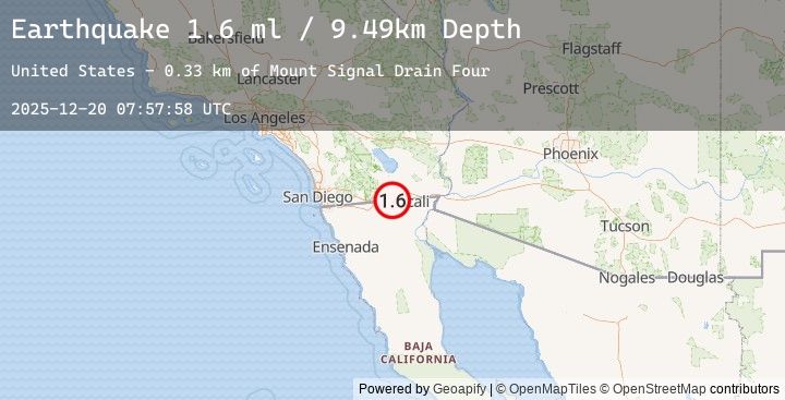
A 1.6 magnitude earthquake struck on 11 km NW of Progreso, B.C., MX, at Sat, 20 Dec 2025 07:57:58 GMT. Depth: 9.49km. Reviewed by USGS seismologists, this minor quake occurred at a magnitude type of ml.
Magnitude
1.6
ml
Source
USGS
Intensity
-
Earthquake Details
AutomaticEvent IDusgs_ci41143583
Tsunami PotentialNo
Magnitude Typeml
Nearest Places
- Mount Signal Drain Four0.3 km
- Walnut Canal0.4 km
- Mount Signal Drain Three0.5 km
- Woodbine Lateral Four1.7 km
- All American Drain Thirteen2.0 km
Comments
Join the discussion about this event.
Latest Earthquakes
1.8Mag
13 km S of Volcano, Hawaii
Time12 minutes ago
Depth3.31 km
SourceUSGS (Automatic)
1.1Mag
9 km NE of Julian, CA
Time15 minutes ago
Depth12.64 km
SourceUSGS (Automatic)
1.7Mag
4 km SE of San Ramon, CA
Time26 minutes ago
Depth8.40 km
SourceUSGS (Automatic)
0.8Mag
9 km NW of The Geysers, CA
Time39 minutes ago
Depth1.60 km
SourceUSGS (Automatic)
1.6Mag
5 km SSW of Redlands, CA
Time40 minutes ago
Depth11.22 km
SourceUSGS (Automatic)
Nearby Earthquakes
1.1Mag
9 km NE of Julian, CA
Time15 minutes ago
Depth12.64 km
SourceUSGS (Automatic)
0.6Mag
10 km NE of Julian, CA
Time2 hours ago
Depth13.16 km
SourceUSGS (Automatic)
1.3Mag
11 km WNW of Imperial, CA
Time4 hours ago
Depth2.42 km
SourceUSGS (Automatic)
1.1Mag
6 km NE of Westmorland, CA
Time8 hours ago
Depth11.08 km
SourceUSGS (Automatic)
1.1Mag
14 km S of Salton City, CA
Time13 hours ago
Depth6.99 km
SourceUSGS (Automatic)