Earthquake 12 km NNE of Aguanga, CA
Sat, 27 Dec 2025 13:56:25 GMT
Time1 hour ago
Location
33.5395, -116.8062
Depth
6.2 KM
Event Summary
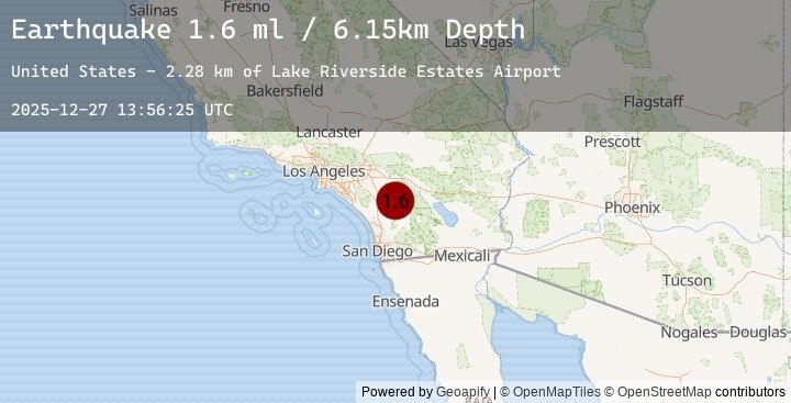
A 1.6 magnitude earthquake struck on 12 km NNE of Aguanga, CA, at Sat, 27 Dec 2025 13:56:25 GMT. Depth: 6.15000009536743km. Reviewed by USGS seismologists, this minor quake occurred at a magnitude type of ml.
Magnitude
1.6
ml
Source
USGS
Intensity
-
Earthquake Details
AutomaticEvent IDusgs_ci41147695
Tsunami PotentialNo
Magnitude Typeml
Nearest Places
Comments
Join the discussion about this event.
Latest Earthquakes
3.1Mag
ISLAND OF HAWAII, HAWAII
Time3 minutes ago
Depth33.90 km
SourceEMSC (Automatic)
3.0Mag
Seram, Indonesia
Time6 minutes ago
Depth14.58 km
SourceBMKG (Automatic)
2.1Mag
Bali Region, Indonesia
Time14 minutes ago
Depth22.11 km
SourceBMKG (Automatic)
1.8Mag
20 km SSE of Pāhala, Hawaii
Time17 minutes ago
Depth31.77 km
SourceUSGS (Automatic)
3.8Mag
NEVADA
Time18 minutes ago
Depth9.70 km
SourceEMSC (Automatic)
Nearby Earthquakes
1.1Mag
21 km E of Julian, CA
Time51 minutes ago
Depth11.19 km
SourceUSGS (Automatic)
0.8Mag
24 km ESE of Anza, CA
Time1 hour ago
Depth11.94 km
SourceUSGS (Automatic)
1.2Mag
15 km NE of Borrego Springs, CA
Time1 hour ago
Depth11.35 km
SourceUSGS (Automatic)
1.4Mag
11 km N of Borrego Springs, CA
Time6 hours ago
Depth12.60 km
SourceUSGS (Automatic)
1.0Mag
11 km N of Cabazon, CA
Time8 hours ago
Depth14.93 km
SourceUSGS (Automatic)