Earthquake 6 km ESE of Rowland Heights, CA
Sun, 28 Dec 2025 23:37:13 GMT
Time3 hours ago
Location
33.9663, -117.8467
Depth
11.0 KM
Event Summary
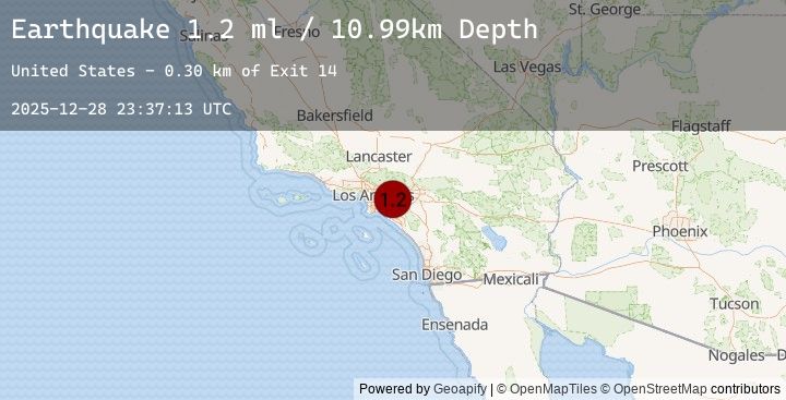
A 1.2 magnitude earthquake struck on 6 km ESE of Rowland Heights, CA, at Sun, 28 Dec 2025 23:37:13 GMT. Depth: 10.9899997711182km. Reviewed by USGS seismologists, this minor quake occurred at a magnitude type of ml.
Magnitude
1.2
ml
Source
USGS
Intensity
-
Earthquake Details
AutomaticEvent IDusgs_ci41148439
Tsunami PotentialNo
Magnitude Typeml
Nearest Places
- Exit 140.3 km
- Castle Rock Elementary School0.7 km
- Heritage Park0.9 km
- Country Hills Town Center Shopping Center1.2 km
- Exit 131.3 km
Comments
Join the discussion about this event.
Latest Earthquakes
2.6Mag
Minahassa Peninsula, Sulawesi
Time1 hour ago
Depth5.00 km
SourceBMKG (Automatic)
4.1Mag
REGION METROPOLITANA, CHILE
Time1 hour ago
Depth116.90 km
SourceEMSC (Automatic)
4.1Mag
48 km E of Villa Presidente Frei, Chile
Time1 hour ago
Depth116.89 km
SourceUSGS
2.0Mag
EASTERN TURKEY
Time1 hour ago
Depth5.00 km
SourceEMSC (Automatic)
3.1Mag
ATACAMA, CHILE
Time1 hour ago
Depth31.80 km
SourceEMSC (Automatic)
Nearby Earthquakes
1.4Mag
7 km NW of Lytle Creek, CA
Time1 hour ago
Depth6.94 km
SourceUSGS (Automatic)
1.4Mag
6 km WNW of Lytle Creek, CA
Time1 hour ago
Depth7.59 km
SourceUSGS (Automatic)
1.0Mag
2 km SSE of San Dimas, CA
Time3 hours ago
Depth10.42 km
SourceUSGS (Automatic)
1.8Mag
9 km SW of Corona, CA
Time3 hours ago
Depth3.77 km
SourceUSGS (Automatic)
1.4Mag
7 km WSW of Corona, CA
Time3 hours ago
Depth7.69 km
SourceUSGS (Automatic)