Earthquake 14 km N of Ocotillo Wells, CA
Fri, 02 Jan 2026 19:13:55 GMT
Time1 hour ago
Location
33.2695, -116.1298
Depth
8.7 KM
Event Summary
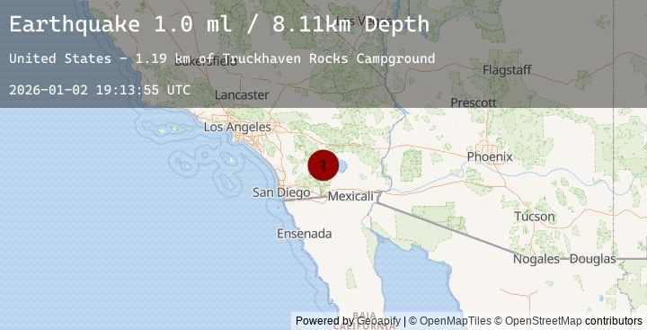
A 0.8 magnitude earthquake struck on 14 km N of Ocotillo Wells, CA, at Fri, 02 Jan 2026 19:13:55 GMT. Depth: 8.7km. Reviewed by USGS seismologists, this minor quake occurred at a magnitude type of ml.
Magnitude
0.8
ml
Source
USGS
Intensity
-
Agency Reports
1 Sources| Source | Magnitude | Depth | Time |
|---|---|---|---|
| USGSPrimary | 0.8 | 9 km | 1 hour ago |
Earthquake Details
AutomaticEvent IDusgs_ci41151159
Tsunami PotentialNo
Magnitude Typeml
Nearest Places
- Truckhaven Rocks Campground1.7 km
- Seventeen Palms Spring2.4 km
- Seventeen Palms2.4 km
- Una Palma2.9 km
- Coachwhip Canyon3.0 km
Comments
Join the discussion about this event.
Latest Earthquakes
3.5Mag
Northern Molucca Sea
Time8 minutes ago
Depth16.36 km
SourceBMKG (Automatic)
2.3Mag
61 km SW of Cantwell, Alaska
Time11 minutes ago
Depth83.80 km
SourceUSGS (Automatic)
1.9Mag
38 km SSE of Naalehu, Hawaii
Time15 minutes ago
Depth6.40 km
SourceUSGS (Automatic)
2.3Mag
West Papua Region, Indonesia
Time19 minutes ago
Depth10.00 km
SourceBMKG (Automatic)
1.5Mag
54 km ESE of Denali Park, Alaska
Time22 minutes ago
Depth2.80 km
SourceUSGS (Automatic)
Nearby Earthquakes
1.4Mag
15 km N of Warner Springs, CA
Time2 hours ago
Depth6.54 km
SourceUSGS (Automatic)
0.8Mag
3 km SW of Borrego Springs, CA
Time4 hours ago
Depth2.52 km
SourceUSGS (Automatic)
1.1Mag
3 km SSE of Brawley, CA
Time10 hours ago
Depth5.86 km
SourceUSGS (Automatic)
1.0Mag
9 km SW of Idyllwild, CA
Time10 hours ago
Depth18.22 km
SourceUSGS (Automatic)
1.2Mag
8 km SSE of Palomar Observatory, CA
Time15 hours ago
Depth14.14 km
SourceUSGS (Automatic)