Earthquake 2 km S of Redlands, CA
Wed, 07 Jan 2026 05:27:32 GMT
Time2 days ago
Location
34.0343, -117.1797
Depth
12.9 KM
Event Summary
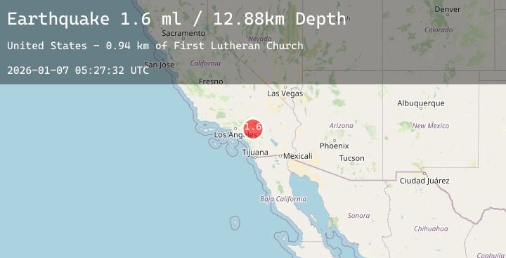
A 1.6 magnitude earthquake struck on 2 km S of Redlands, CA, at Wed, 07 Jan 2026 05:27:32 GMT. Depth: 12.8800001144409km. Reviewed by USGS seismologists, this minor quake occurred at a magnitude type of ml.
Magnitude
1.6
ml
Source
USGS
Intensity
-
Agency Reports
3 Sources| Source | Magnitude | Depth | Time |
|---|---|---|---|
| USGSPrimary | 1.6 | 13 km | 2 days ago |
| USGSPrimary | 1.0 | 5 km | 2 days ago |
| USGSPrimary | 0.8 | 2 km | 2 days ago |
Earthquake Details
AutomaticEvent IDusgs_ci41153367
Tsunami PotentialNo
Magnitude Typeml
Nearest Places
- First Lutheran Church0.9 km
- Prospect Park1.0 km
- Hillside Cemetery1.0 km
- Cope Middle High School1.1 km
- Smiley Heights1.2 km
Comments
Join the discussion about this event.
Latest Earthquakes
3.5Mag
KODIAK ISLAND REGION, ALASKA
Time2 days ago
Depth27.20 km
SourceAK (Automatic)
1.2Mag
9 km E of Alum Rock, CA
Time2 days ago
Depth3.78 km
SourceUSGS (Automatic)
1.7Mag
20 km NNE of Fishhook, Alaska
Time2 days ago
Depth20.10 km
SourceUSGS (Automatic)
3.2Mag
Near North Coast of West Papua
Time2 days ago
Depth10.00 km
SourceBMKG (Automatic)
0.8Mag
4 km NNW of The Geysers, CA
Time2 days ago
Depth2.38 km
SourceUSGS (Automatic)
Nearby Earthquakes
1.2Mag
13 km N of Banning, CA
Time3 days ago
Depth10.67 km
SourceUSGS (Automatic)
1.3Mag
4 km W of Monterey Park, CA
Time3 days ago
Depth12.85 km
SourceUSGS (Automatic)
0.7Mag
1 km N of Banning, CA
Time3 days ago
Depth6.58 km
SourceUSGS (Automatic)
1.0Mag
7 km NNE of Fontana, CA
Time3 days ago
Depth6.13 km
SourceUSGS (Automatic)
1.6Mag
11 km NE of Trabuco Canyon, CA
Time3 days ago
Depth7.99 km
SourceUSGS (Automatic)