Earthquake 12 km WSW of Lytle Creek, CA
Thu, 08 Jan 2026 23:45:28 GMT
Time2 days ago
Location
34.2350, -117.6238
Depth
4.8 KM
Event Summary
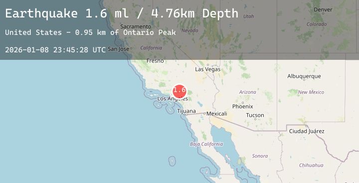
A 1.6 magnitude earthquake struck on 12 km WSW of Lytle Creek, CA, at Thu, 08 Jan 2026 23:45:28 GMT. Depth: 4.76km. Reviewed by USGS seismologists, this minor quake occurred at a magnitude type of ml.
Magnitude
1.6
ml
Source
USGS
Intensity
-
Agency Reports
1 Sources| Source | Magnitude | Depth | Time |
|---|---|---|---|
| USGSPrimary | 1.6 | 5 km | 2 days ago |
Earthquake Details
AutomaticEvent IDusgs_ci41154607
Tsunami PotentialNo
Magnitude Typeml
Nearest Places
- Ontario Peak0.8 km
- Sheep Flat1.2 km
- Sugarloaf Peak1.3 km
- Ontario Peak Trail1.3 km
- Fir Draw1.5 km
Comments
Join the discussion about this event.
Latest Earthquakes
0.7Mag
8 km WNW of Cobb, CA
Time2 days ago
Depth1.36 km
SourceUSGS (Automatic)
2.3Mag
ALBANIA
Time2 days ago
Depth15.00 km
SourceIGEO (Automatic)
2.9Mag
NEAR COAST OF NICARAGUA
Time2 days ago
Depth19.00 km
SourceINET (Automatic)
4.0Mag
CENTRAL PERU
Time2 days ago
Depth104.00 km
SourceLIM (Automatic)
2.3Mag
WESTERN TURKEY
Time2 days ago
Depth87.60 km
SourceKOERI (Automatic)
Nearby Earthquakes
1.3Mag
3 km ENE of Pico Rivera, CA
Time2 days ago
Depth4.14 km
SourceUSGS (Automatic)
1.2Mag
2 km NNW of Baldwin Park, CA
Time2 days ago
Depth12.34 km
SourceUSGS (Automatic)
1.1Mag
3 km SE of Loma Linda, CA
Time2 days ago
Depth16.61 km
SourceUSGS (Automatic)
1.2Mag
1 km E of Colton, CA
Time3 days ago
Depth15.49 km
SourceUSGS (Automatic)
1.4Mag
3 km ESE of Loma Linda, CA
Time3 days ago
Depth13.80 km
SourceUSGS (Automatic)